ST. LOUIS — A National Weather Service meteorologist has issued a dire warning about the severe weather chances in the St. Louis metro area for Friday night, comparing them to three systems that produced severe tornadoes in the past 14 years.
“I’ve never done this in my career,” started the warning from Acting Meteorologist in Charge Kevin Deitsch to his National Weather Service partners.
“This is a life-threatening situation,” he said.
5 On Your Side Meteorologists have been cautioning all week about the possibility of a very quick but intense band of storms that could produce strong tornadoes that could last for some duration. The speed at which the system is moving may also not give a lot of warning time.
“We are most concerned with the timing on a Friday evening where many fish frys, sporting activities, and other gatherings are ongoing in large, commercial structures where roofs can easily fail,” said Deitsch.
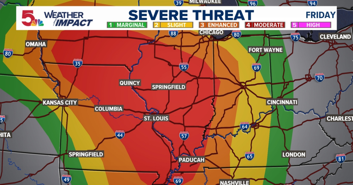
According to KSDK meteorologists, the bullseye of the severe weather threat is right over our area. We remain at a “moderate” risk for severe weather. This is level 4 of 5 that the Storm Prediction Center issues ahead of a severe weather threat. The ingredients are coming together for a significant severe weather event in our area this evening.
The main focal point for development is part of a larger center of low pressure that is centered somewhere in Nebraska by this afternoon. Along it, a dry line (the focal point for our storm development), and a cold front behind it. Storms should begin to fire along this by Friday afternoon to the west, and continue to race our direction.
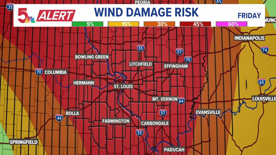
That’s why the primary risk for this storm will be wind damage. As you can see from the sub-products issued by the Storm Prediction Center, we are highlighted in a 45% area. What does this exactly mean? It means that there is a high likelihood that 60+ mph wind damage is expected within 25 miles of any point in that area. The black lines across (hatched area,) signifies 70+ mph damage probability within that 25 miles.