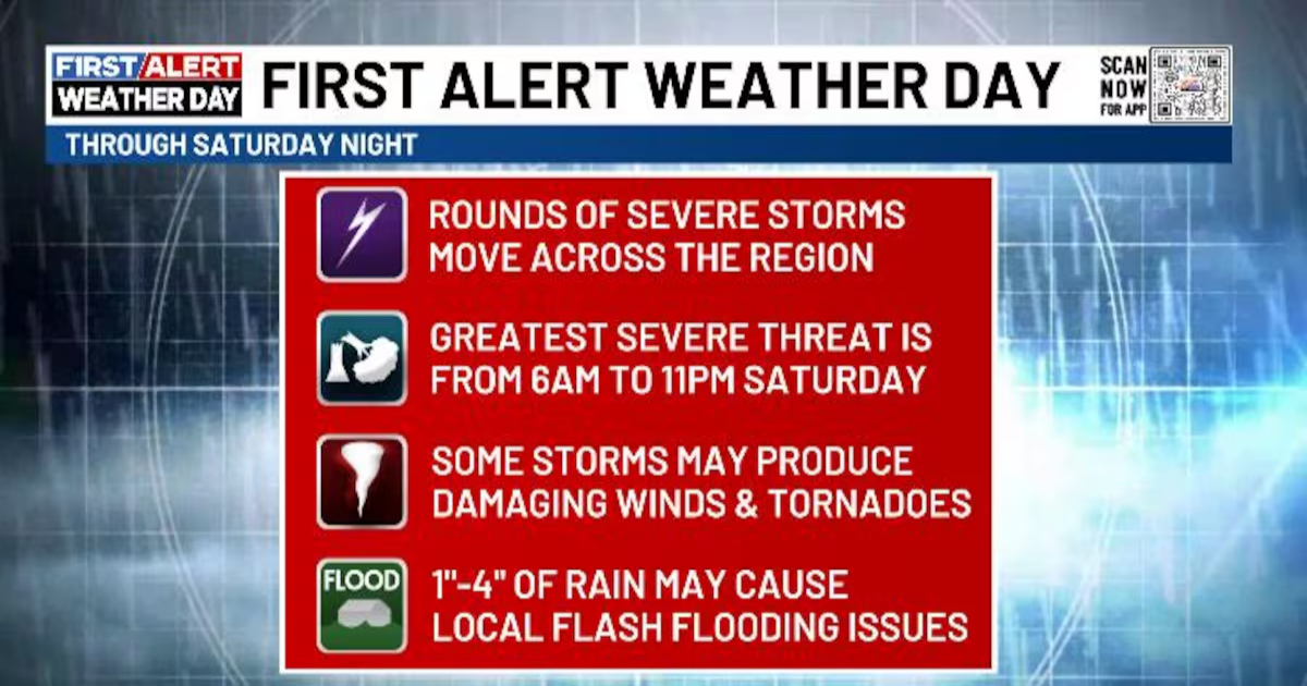
LEXINGTON, Ky. (WKYT) – A major severe weather outbreak for a large chunk of the country kicks off today and lasts into Saturday.
While Kentucky won’t see the worst of this, we will still be dealing with severe storms, high winds and local flash flooding issues.
TODAY
- Temps surge into the 75-80 degree range under mostly sunny skies.
- Winds crank from the southwest with gusts reaching 30mph-40mph by late in the afternoon across the west.
FRIDAY NIGHT
- Lines of strong to severe storms rumble into western Kentucky late Friday evening through the wee hours of Saturday.
- That line of storms then pushes eastward into central Kentucky and weakens by sunup Saturday
- The greatest threat for severe storms is across western and parts of central Kentucky.
- Damaging winds and a few tornadoes are possible in the west.
- With or without storms, wind gusts of 50mph or greater may be noted.
SATURDAY
- Our cold front moves into western Kentucky and slows down.
- Low pressure develops along this to our southwest and rides northeastward along it.
- This brings the potential for rounds of strong to severe storms to central and eastern Kentucky especially.
- Damaging winds are the main player with these storms but I can’t rule out isolated tornadoes.
- With or without storms, winds may gust to 50mph or greater at times.
- Significant wind damage is possible late Saturday afternoon and evening.
- These storms may also be big rainmakers in streaks. Local flash flooding is a good bet with the greatest potential across central Kentucky Saturday evening.
Copyright 2025 WKYT. All rights reserved.