Slate Auto, a firm backed in part by Amazon founder Jeff Bezos, is unveiling a low-cost electric truck that can also change into an SUV.
Its starting price point: $20,000 after federal EV incentives.
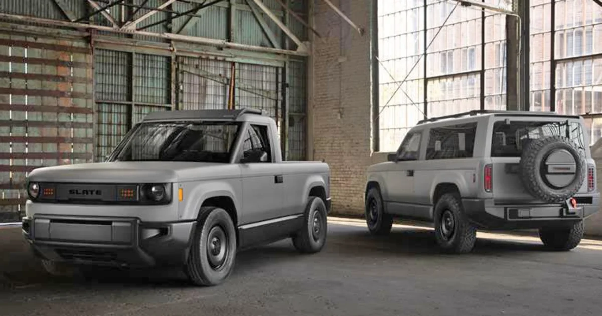
“A radically simple electric pickup truck that can change into whatever you need it to be — even an SUV,” the Slate Auto website says. “Made in the USA at a price that’s actually affordable (no really, for real).”
The two-door version can be changed into a 5-seat SUV. The baseline truck is small: About two-thirds the size of a Chevy Silverado EV and about seven-eights the size of a Ford Maverick. It has a payload capacity of 1,400 pounds compared the Maverick’s 1500 pounds.
At less than 15 feet long, Slate says its more akin to a 1985 Toyota pickup.
Its smaller and less gaudy stature are by design: TechCrunch refers to the Slate as an “anti-Tesla,” and while both the Slate Truck and the Cybertruck are customizable, the starting Slate model is stripped down to essential elements, including no power windows or infotainment screen.
The specs show a maximum range of 150 miles on a single charge, with the option for a longer-range battery pack that could offer up to 240 miles. The vehicles are designed in California and Michigan, engineered in Michigan, and assembled somewhere in the Midwest, according to Slate’s website. TechCrunch reported the plant is in Indiana.
Earlier this month, TechCrunch broke the news that Bezos, along with the controlling owner of the Los Angeles Dodgers, Mark Walter; and a third investor, Thomas Tull, had helped Slate raise $111 million for the project. A document filed with the Securities and Exchange Commission listed Melinda Lewison, the head of Bezos’ family office, as a Slate Auto director.
The vehicles aren’t expected to be delivered to customers until late 2026, but can be reserved for a refundable $50 fee.