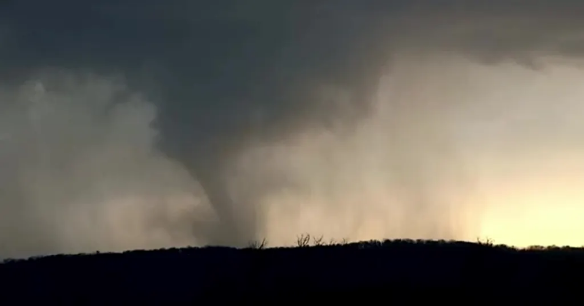
- Supercell thunderstorms may produce very large hail, damaging winds and strong tornadoes.
- The highest risk for strong, long-track tornadoes lasts into Monday evening.
- More than 45 million people from Texas to the Upper Midwest face the risk of severe weather on Monday.
MINNEAPOLIS – Preparations are underway in Minneapolis and other communities across the Upper Midwest ahead of a likely severe weather outbreak on Monday that could blast the region with powerful thunderstorms capable of producing very large hail, damaging wind gusts and strong tornadoes.
The City of Minneapolis sent out a warning on Sunday urging residents to prepare for the incoming extreme weather, and officials in the city of Edina echoed that warning.
“Prepare now,” the Edina Police and Fire Departments said in a post on X. “Identify storm shelter locations, fully charge cell phones and backup batteries, have multiple ways to receive National Weather Service Warnings, and secure outdoor objects, such as furniture and trash cans.”
It’s been a quiet start to the new workweek so far, but that’s expected to change dramatically as we get into the afternoon and evening hours.
“We have no warnings that we’re waking up to at this moment,” FOX Weather Meteorologist Britta Merwin said. “But then this afternoon, a more widespread threat, and the afternoon and evening setup for parts of northern Iowa, Minnesota and also western Wisconsin is quite concerning.”
The FOX Forecast Center said the strong storm system will move quickly through the region, fueled by a powerful jet stream overhead and a strengthening surface low-pressure system moving from the northern Plains into the Great Lakes region.
Warm, moist air will surge northward ahead of the system, setting the stage for a very unstable atmosphere by midday, especially across portions of Iowa, Minnesota and Wisconsin.
DOWNLOAD THE FREE FOX WEATHER APP

(FOX Weather)
In total, more than 45 million people from the U.S.–Mexico border in Texas to the U.S.-Canada border in the Upper Midwest will be at risk of severe weather on Monday.
However, the threat is significantly higher on the northern end of that risk zone, where more than 5 million people have been placed in a Level 4 out of 5 risk on NOAA’s Storm Prediction Center’s (SPC) severe thunderstorm risk scale.
The heightened risk zone includes cities like Minneapolis, St. Paul, Rochester, Bloomington and Plymouth in Minnesota and Eau Claire and La Crosse in Wisconsin.
TORNADOES HIT LARGE CITIES: THIS IS WHY
Forecasters say all severe weather threats are possible with the thunderstorms that develop on Monday.
This includes the threat of very large hail over 2 inches and destructive wind gusts. Strong tornadoes (EF-2 or higher) are also possible, especially across portions of Minnesota, Iowa and Wisconsin.
That heightened tornado threat includes more than 11 million people in cities like Minneapolis and St. Paul, Madison in Wisconsin, Des Moines in Iowa and Rockford in Illinois.
Multiday severe weather threat extends into Tuesday
 This graphic shows the severe weather threat on Tuesday, April 29, 2025.
(FOX Weather)
The multiday severe weather threat will continue into Tuesday, putting even more people at risk of extreme weather.
More than 65 million people from Texas to the Northeast will be at risk of severe weather. However, the highest threat will be centered from central Ohio into western Pennsylvania and western and central New York, where the SPC has posted a Level 3 out of 5 risk.
This Level 3 risk zone includes some 11.5 million people in cities such as Columbus and Cleveland in Ohio, Pittsburgh in Pennsylvania and Rochester in New York.