KANSAS CITY, Mo. (KCTV) – NEW: A Tornado Watch is in effect for Henry, Cooper, Pettis, Howard, Bates and Linn, Kansas, counties now through 7 p.m. This means the conditions are right for a tornado to occur.
Flash flooding is reported in parts of Warrensburg on Northeast 200 and 300 Roads, Southeast 200th Road near West Bear Creek, Northeast Division Road, and 121 Road near U.S. Highway 50.
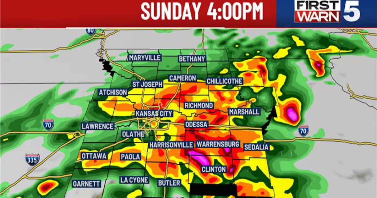
A First Warn Weather Day is in place as the severe weather potential is increasing between now through 7 p.m. Storms are starting to fire up just to the south of the viewing area and will track north, impacting areas south of I-70 first. These storms will continue to intensify as they move north and east through the area along the cold front. These storms are capable of producing tornadoes, swaths of damaging winds, hail and flooding.
From the Storms Prediction Center, the enhanced risk (level 3 out of 5) has shifted towards the east, with only Marshall, Warrensburg, and Sedalia in the best area for severe weather. The Kansas City metro is under the marginal risk (level 1 out of 5) and areas east of KC are under a slight risk (level 2 out of 5).
Easter Sunday severe risk(KCTV5)
SEVERE WEATHER TIMING
The atmosphere has been able to recover with a lot of dry time from the past few hours, which has resulted in severe weather chances continuing for this afternoon. Areas south of I-70 could see severe storms between 1-3 p.m. This severe weather chance will be moving north along with the system. So, Kansas City could see the strong/severe storms between 3–5 p.m. The far eastern counties could experience the potential for severe weather through 6 p.m. Areas way north of east of KC will see the activity between 5–7 p.m. before it moves out.
Aside from the severe weather risk, there is a flood risk for heavy rainfall for today for areas south and east of Kansas City through 7 p.m. tonight. These areas could see upwards of 1.5–3 inches of rain.
REST OF THE WEEK
After today, temperatures will be warming up to the low 70s on Monday with sunny skies. Tuesday’s temperatures will warm up very quickly with highs in the upper 70s. However, the active weather doesn’t stay away long. Another cold front will move through Tuesday night, bringing additional chances for showers and storms. A First Warn is in place for Wednesday and Thursday as storm and rain chances continue to increase as the front stalls out over the area.
Copyright 2025 KCTV. All rights reserved.