Severe thunderstorms are expected across parts of Texas starting Tuesday, ending a short period of dryness.
Michael Beard
Spring weather across Texas continues to be a roller coaster experience, with rainy conditions Sunday leading to temporary dryness in some parts through early Tuesday. But starting Tuesday afternoon, much of the Lone Star State could be in for heavy thunderstorm action, with some areas even seeing large hail and damaging winds.
Conditions should start to shift around noon Tuesday starting in the Texas Panhandle, according to the National Weather Service. Low-level moisture is forecast to come up from the Gulf of Mexico and bring possible precipitation to areas around Amarillo. Forecasters aren’t yet certain about the amount of rain, but they say “strong to severe” storms are in the cards.
Article continues below this ad
“Low-level wind shear looks unimpressive at this point, leading to the primary threats being hail and damaging winds,” the NWS wrote Saturday. “The overall weather pattern doesn’t look to chance much on Wednesday, either, and should thunderstorms develop they could become strong to severe again.”
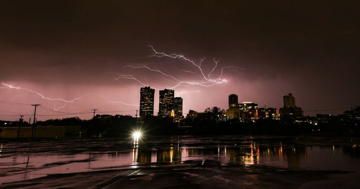
Southerly winds could bring havoc to the Dallas-Fort Worth metroplex, as well, starting Tuesday. The NWS said Saturday that stormy activity is possible and would be more widespread from Tuesday afternoon to Wednesday morning.
“Several fast moving disturbances will spread through the Southern Plains Tuesday through Friday and we’ll continue to see a period of active weather including the threat for severe storms,” wrote the NWS.
The Houston metro area is bound to see considerable rain, as well, also with “daily chances” for storms essentially from Tuesday to Friday. The NWS said the rain has been rare as of late, as “Houston hasn’t seen measurable rainfall since April 5.”
Article continues below this ad
“On average, we should be around 14 inches of rain by the end of April and we’re currently at 10.37 inches, so this active pattern should help us catch back up near to where we should be,” wrote the NWS.
That said, the NWS didn’t rule out that some of the rainfall this week could be excessive, with a chance that areas could see upwards of 2-3 inches of the wet stuff. High temperatures for the early part of the week should remain in the low to mid 80s throughout Southeast Texas.