COLUMBUS, Ohio — As soon as one round of severe weather moves out of Central Ohio, another round is on the way.
A quick-moving, strong weather system will develop in the coming days and set sights on central Ohio by Wednesday. Warm air is expected to once again surge into the region, with temps pushing into the mid-70s by Wednesday afternoon. This will set off a round of strong to severe storms and bring lots of heavy rain.
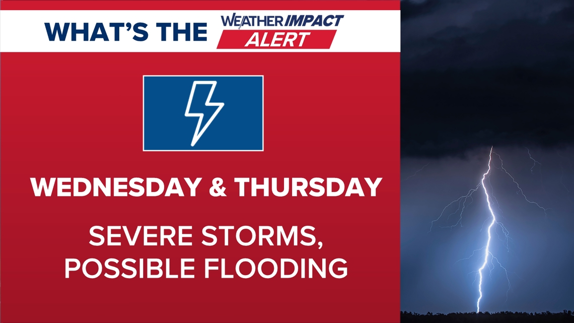
These impacts will start Wednesday afternoon and continue through Thursday. For these reasons, two 10TV Weather Impact Alert Days have been declared, one for the second half of Wednesday, and the other for all of Thursday.

This will break down into two primary concerns: severe weather and flooding rain.
As of now, the highest risk for severe storms comes through Wednesday afternoon into Wednesday night, when all modes of severe weather are possible. This could include single-cell thunderstorms and eventually a more broad area of convection.
Make sure you have a plan to get weather alerts and information as we head into the second half of the day. We’re already under an elevated risk for severe weather Wednesday.

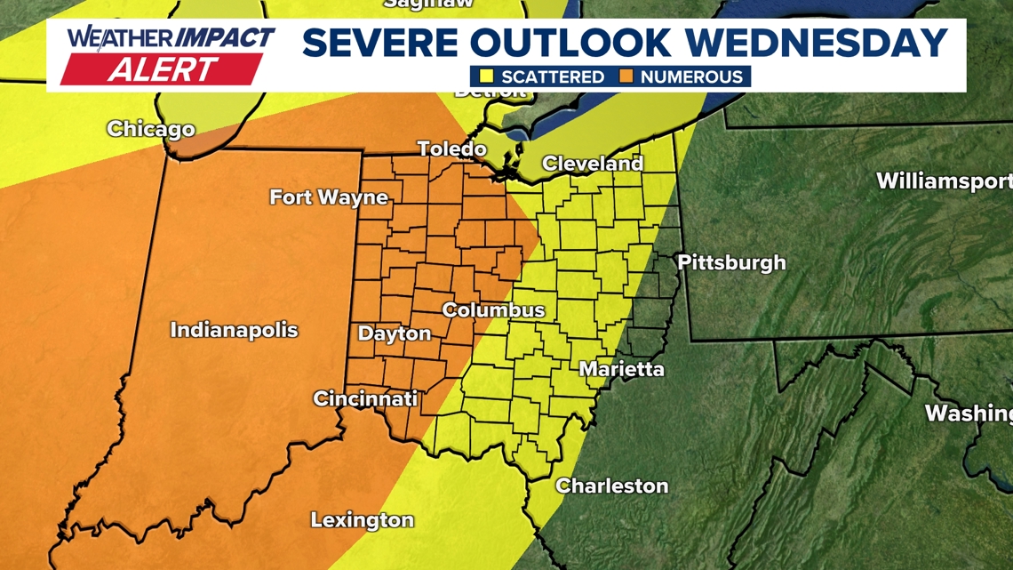
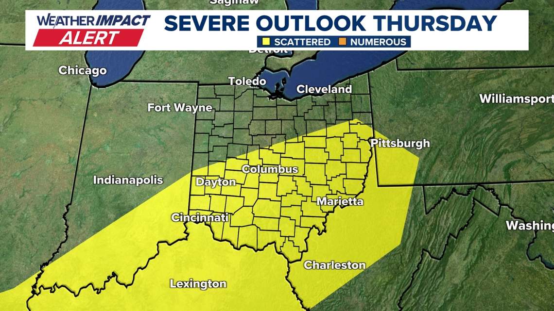
The threat of severe storms will continue into Thursday as well, but this threat is a bit more uncertain. Regardless, the Storm Prediction Center also has many locations in central Ohio under a severe weather risk again for storms on Thursday.
This threat looks to be a bit more likely south of I-70, but this is subject to change between now and then.

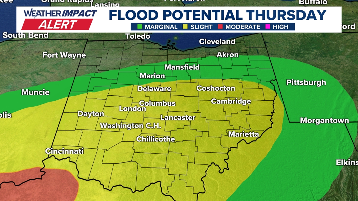
Flooding will be a concern with storms on both days, as a large push of rainfall looks possible late Wednesday through the day on Thursday. Areas around central Ohio should be prepared for possible standing water in areas more prone to flooding. Use extra caution when driving, especially at night.

The 10 Weather Impact team will continue to refine these risks and our forecast as we get closer to the midweek. For now, stay weather-aware and stick with us for the latest forecast updates as we dig into the data this week!
