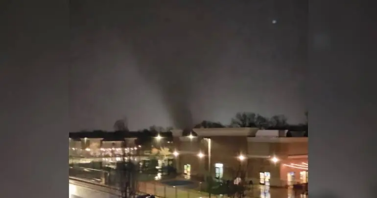
INDIANAPOLIS – For the second time this week, severe weather battered parts of central Indiana.
A powerful storm swept through several communities, leaving behind a trail of damage. Multiple storm reports indicated wind damage, large hail, flash flooding and tornadoes.
The wind gusts were significant. Eaton in Delaware County reported a gust of 100 mph, while Lapel in Madison County recorded an 87-mph gust. Other significant wind gusts were 81 mph (Danville, Hendricks County), 80 mph (Homecroft, Marion County), 79 mph (western Madison County) and 73 mph (Greencastle, Putnam County).

Many viewers reported downed trees, branches and power lines. Some counties had travel restrictions as debris littered area roads. In our viewing area, Hendricks and Brown counties initiated orange travel watches, while Delaware County called for a yellow travel advisory.
Some schools were closed, delayed or elected for e-learning days in the storm’s aftermath.
They included Indianapolis Public Schools, which opted for an asynchronous learning day for Thursday. The district said power outages at multiple buildings led to the decision.
Power outages remained a problem in several communities. Poweroutage.us, a website that tracks utility disruptions, reported more than 96,000 outages as of about 7:30 a.m. Thursday. AES Indiana reported more than 24,000 outages in its coverage area.
 Storm reports from Wednesday
Other counties with significant outages included Hendricks, Madison (more than 10,000) and Delaware. To the south, Jackson County reported more than 4,000 outages. Earlier in the morning, Jackson reported some 10,000 outages.
The numbers were expected to fluctuate throughout the morning as crews worked to restore service.
The first tornado warning for central Indiana was activated at 8:29 p.m. in Putnam County. From that point forward, warnings proceeded for more than two hours as the storm swept across the area.
Forecasters are confident a tornado hit, based on video and indications on radar. It’s a question of whether the storm spawned multiple tornadoes or if a single tornado bounded through multiple counties. Survey teams from the National Weather Service will make that determination.
The NWS said its first assessments will come from Brownsburg, Carmel and New Goshen (Vigo County).
 Tree down in Chesterfield/Photo courtesy of Kelsi Goodling
 INDOT cameras in the area appear to show a downed power line or lamp post impeding traffic on I-465 southbound near mile marker 12.3
 Downed tree near S. Missouri Street and Thompson Road
 Flooding near Southeastern and S Sherman/Photo via IMPD
 Damage in Danville/Rafael Sanchez
 Damage in Brownsburg
 Damage in Brownsburg/Anna Darling
 Damage in Brownsburg/Anna Darling
 Damage in Brownsburg/Anna Darling
 Damage in Brownsburg/Anna Darling
Brownsburg endured some of the worst of the storm, with extensive damage reported in the area. The Weather Authority team said a tornado hit around 9:15 a.m.
A warehouse on Northfield Drive sustained significant damage. According to the Brownsburg Fire Territory, a person was trapped inside the building for more than 40 minutes. Crews were dispatched around 9:30 p.m. after a wall at the facility collapsed.
Coworkers helped two people out of the building, but one worker remained trapped inside. Firefighters brought in large extraction tools and tow trucks to extricate the individual, who was taken to an area hospital.
The county remained under an orange travel watch, which means only essential travel is recommended. Drivers should use additional caution.
FOX59/CBS4 also learned about a death investigation in Danville that may involve a storm-related fatality.
Sources said the investigation was taking place near the high school. A man was getting out of his vehicle Wednesday night when it appeared he hit or stepped on a power line, sources told our Rafael Sanchez.
An initial police report from the Hendricks County Sheriff’s Office listed the case as an undetermined death investigation.
Video captured what appeared to be a tornado hitting Carmel.
Videos from viewers showed a storm rotating. One video shot near 116th and College showed a funnel cloud in the distance with a large amount of lightning.
Another viewer photo showed damage to the Ritron Inc. building in Carmel. Trees littered the area and the storm tore off some letters from the building. Damage was also reported at the Carmel Old Town Antique Mall, where it appeared the storm tore off the side of the building.
There were numerous reports of downed trees and powerlines across the area, along with reports about high water.
Several storm reports also came in from Delaware and Madison counties. Gusting winds, flooding and downed trees/powerlines were among the issues reported there.
In Edgewood, a report to the National Weather Service indicated damage to multiple homes and businesses. The report also said some roads were impassable due to large amounts of storm debris.
An 87-mph wind gust was reported in Lapel.
In Delaware County, Eaton reported a 100-mph wind gust. Street flooding was reported near Ball State University.
The storm tore down trees and powerlines in Yorktown, one report indicated. In Gaston, utility lines were down and sheet metal littered North County Road 600 West and Conner Road.
