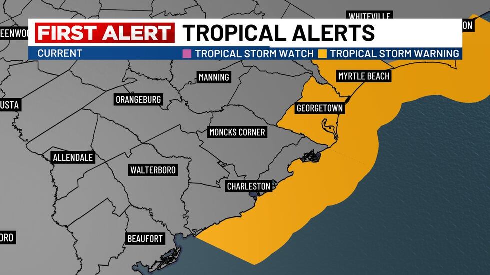
CHARLESTON, S.C. (WCSC) – The National Hurricane Center has discontinued the Tropical Storm Watch that was in effect for Charleston County.
A Tropical Storm Warning remains in effect from the South Santee River to Surf City, North Carolina.
A Tropical Storm Warning remains in effect from the South Santee River to Surf City, North Carolina.(Live 5)
A Tropical Storm Warning means that tropical storm conditions are expected somewhere within the warning area, in this case for the next 6-12 hours.
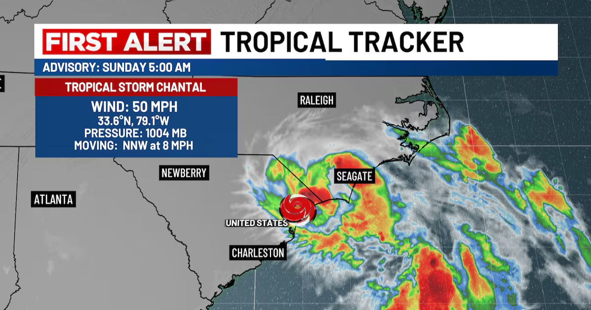
As of 5 a.m., the center of Tropical Storm Chantal was located near latitude 33.6 North, longitude 79.1 West, or about 70 miles northeast of Charleston. Chantal is moving toward the north-northwest near 8 miles per hour. A turn northward and then northeastward is anticipated over the next 24 hours.

The National Hurricane Center has discontinued the Tropical Storm Watch that was in effect for Charleston County as Chantal moves further inland.(Live 5)
On the forecast track, the center of Chantal is expected to move further inland into South Carolina and then North Carolina through the day today.
Maximum sustained winds have decreased to near 50 mph with higher gusts. Rapid weakening is anticipated now that Chantal has made landfall, with the system opening up into a trough in 36-48 hours.
Tropical-storm-force winds extend outward up to 115 miles from the center. In the past couple of hours, a sustained wind of 45 mph was reported at Apache Pier, South Carolina.
The estimated minimum central pressure based on nearby surface observations is 1004 mb or 29.65 inches.
Copyright 2025 WCSC. All rights reserved.