BIRMINGHAM, Ala. (WBRC) – Good morning!
We have declared a First Alert Weather Day for Monday, March 31, as a storm system moves east to kick off the work week.
FIRST ALERT WEATHER DAY: A Severe Thunderstorm Watch has been issued for all of Central Alabama through noon Monday.
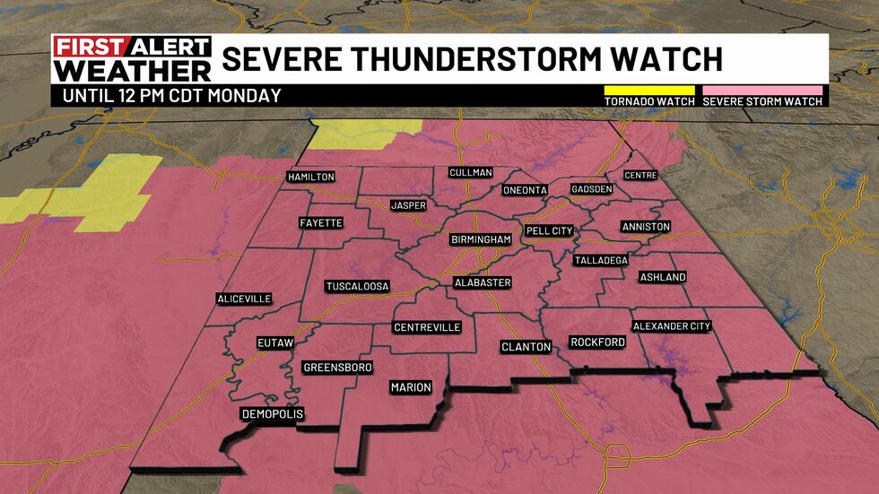
Severe Thunderstorm Watch(WBRC)
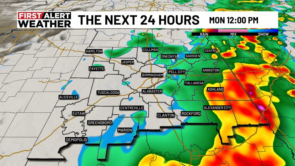
Any storms that move through this morning could produce localized flooding, damaging winds, large hail, and isolated tornadoes.
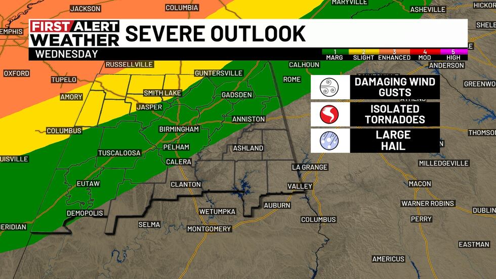
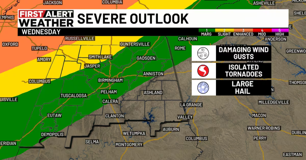
Severe Outlook(WBRC)
The severe threat will impact the morning commute. It will likely be wet, stormy, and windy with slick roads, so plan for extra travel time. A good one to two inches of rain is possible. A few trailing thundershowers could pass through behind the main line, but otherwise, expect drier conditions as the day continues.

The Next 24 Hours(WBRC)
The Next 24 Hours(WBRC)
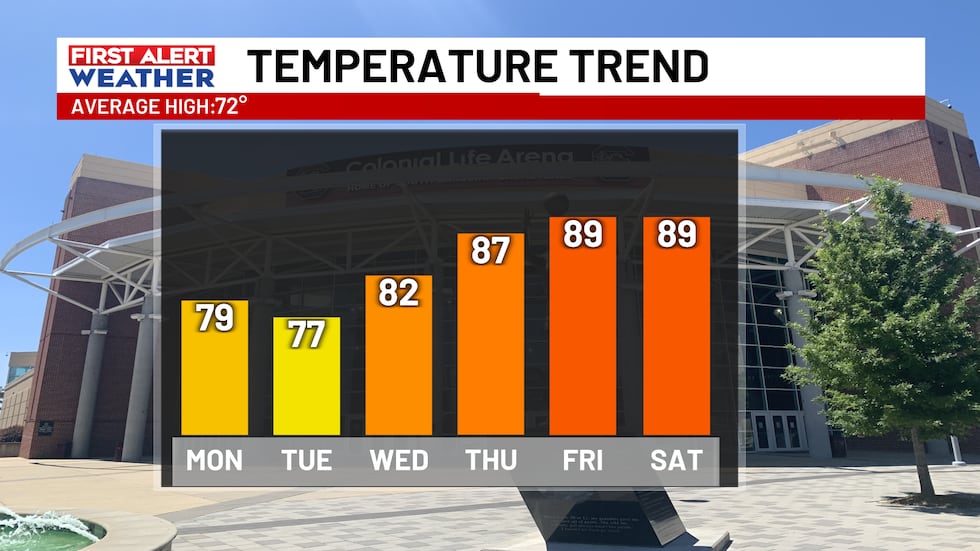
WARM WEEK AHEAD: The cold front associated with today’s storm system will briefly drop morning lows into the 40s on Tuesday. Temperatures will rise into the upper 70s on Tuesday, but a warm front lifting through later in the day will bring another surge of unseasonably warm and muggy air to settle in for the rest of the week.
Morning lows will only fall into the upper 60s, with afternoon highs soaring well above average into the upper 80s — near record-breaking levels for early April! With the increasing humidity levels, the heat index could reach 90 degrees! So, some hints of summer are in the forecast, thanks to a strong ridge of high pressure building to our east across the Atlantic.
WIS(WIS)
RAIN THIS WEEK: Rain this week will be slim each day, around 20%. There is a Marginal Risk (level 1/5) for storms on Wednesday for central and northwest Alabama. A Slight Risk (level 2/5) for Lamar, Marion, Winston, Cullman & Walker counties. At this time, the threat looks very low, but any storm that develops could contain strong gusty winds.
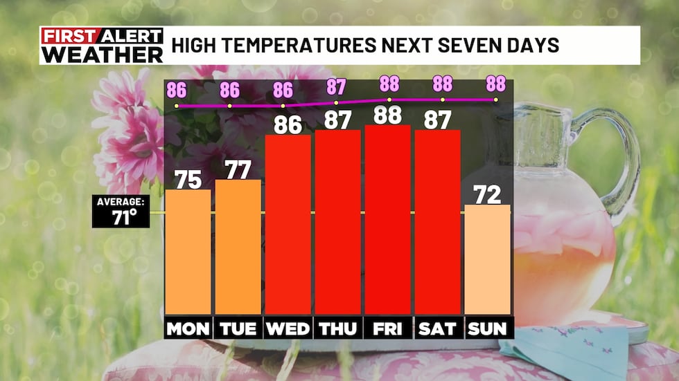
High Temperatures Next Seven Days(WBRC)
LOOKING AHEAD: Another storm system could head for Alabama this coming Sunday, bringing rain and storms back to the forecast for the latter half of the weekend. Some models suggest a strong cold front associated with this system could bring a significant cooldown heading next week. Too early for specifics, but we’ll keep you posted. Bottom line: Don’t get too comfortable planting in your gardens yet!
Make sure you download the WBRC First Alert Weather app on Android and Apple devices for the latest weather information.
Get news alerts in the Apple App Store and Google Play Store or subscribe to our email newsletter here.
Copyright 2025 WBRC. All rights reserved.