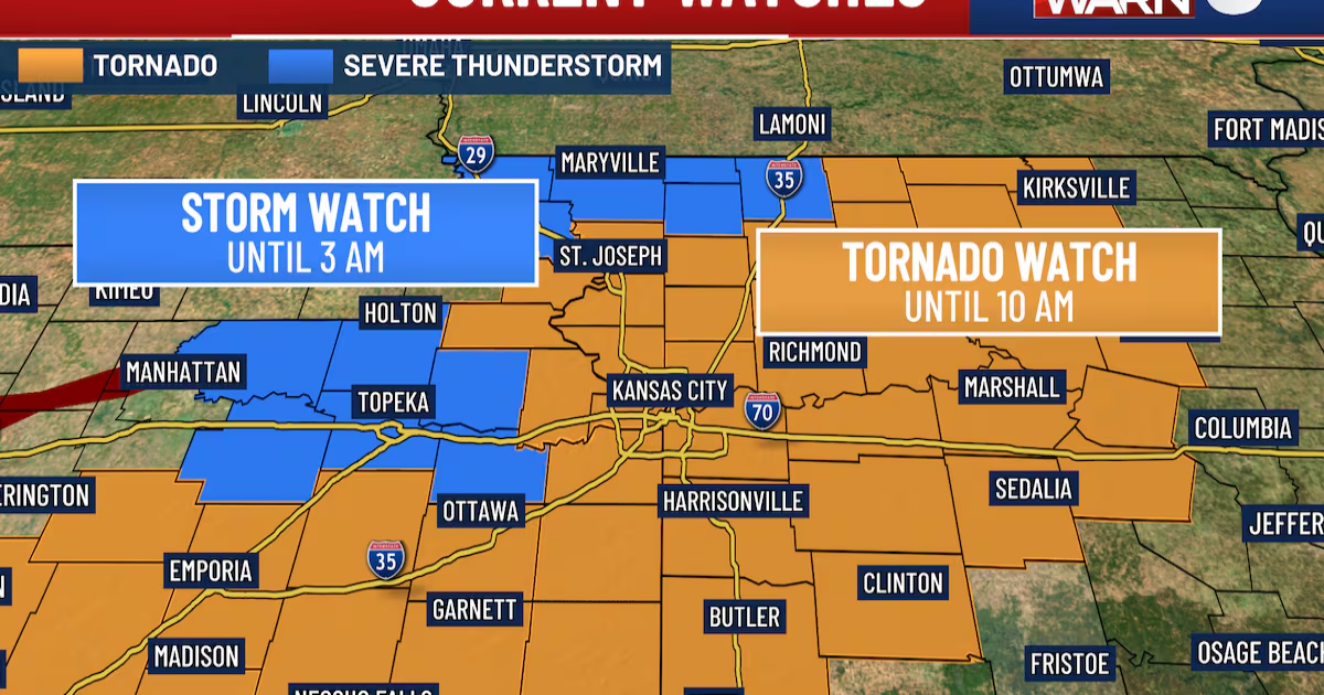
KANSAS CITY, Mo. (KCTV) – Update: Around 7:20 a.m., a tornado was confirmed to be on the ground between Bates and Henry County.
WEDNESDAY MORNING STORMS
Strong to severe storms are moving through the early morning. The latest information indicates the metro will see strong to severe storms between 4 and 7 a.m.
The storms can produce torrential rain, frequent lightning, damaging wind, hail in various sizes, and the potential for a developing tornado. These storms can knock out power, take down trees or break branches, possibly tear shingles off roofs, and lift small objects into the air. Commuting will be extremely hazardous and should be avoided if possible.
To monitor active radar, click here.
TIMING OF WHAT WHEN
We anticipate the storms to be east of the metro between 7 – 8 a.m., with the entire storm system exiting by 10 a.m. Rainfall predictions indicate more than an inch of rainfall within the metro in just four hours. Bonding or pooling on neighborhood roads are expected, and even minor flooding. Once the storm system passes, gusts up to 35 mph will be common for the rest of the day, with temperatures increasing to the upper 60s and lower 70s.
REST OF THE WEEK
Cloud cover and rain chances will continue through the rest of the work week into the weekend. Better rain chances Friday and Saturday. Severe weather activity is concentrated well to the south of the viewing area during this time, but a few isolated thunderstorms cannot be ruled out. During this time, morning temps will start in the 40s, moving to the mid-50s by the afternoon. However, we see a fall to near freezing Sunday through Tuesday morning. Fortunately, dryer air and clear skies are anticipated Sunday afternoon and into next week. allowing afternoon temperatures to slowly rise. By Tuesday, temperatures are anticipated in the middle 60s.
To get the latest weather updates sent to your phone, download the KCTV5 Weather app here.
Copyright 2025 KCTV. All rights reserved.
