Sunday, July 6 2025
Morning Report
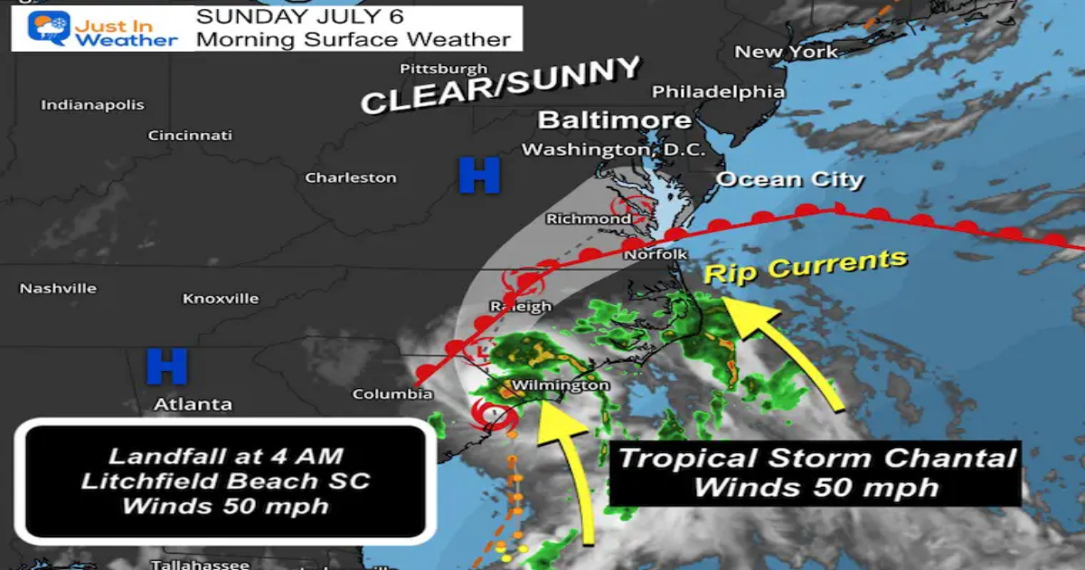
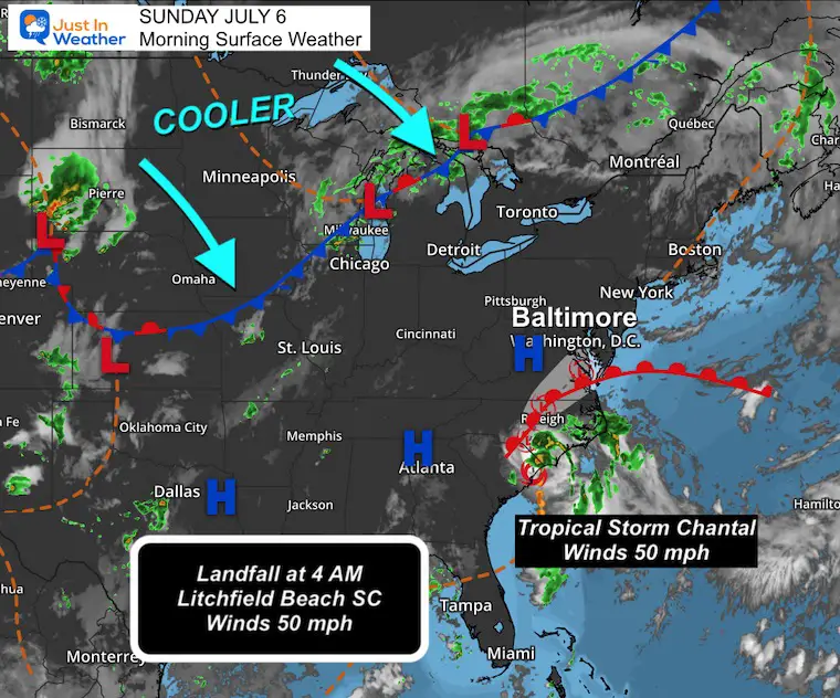
Tropical Storm Chantal made landfall this morning around 4 AM in Litchfield Beach, SC. Winds were 50 mph, which will weaken as it continues inland. The broad reach of tropical storm winds extended 115 miles away.
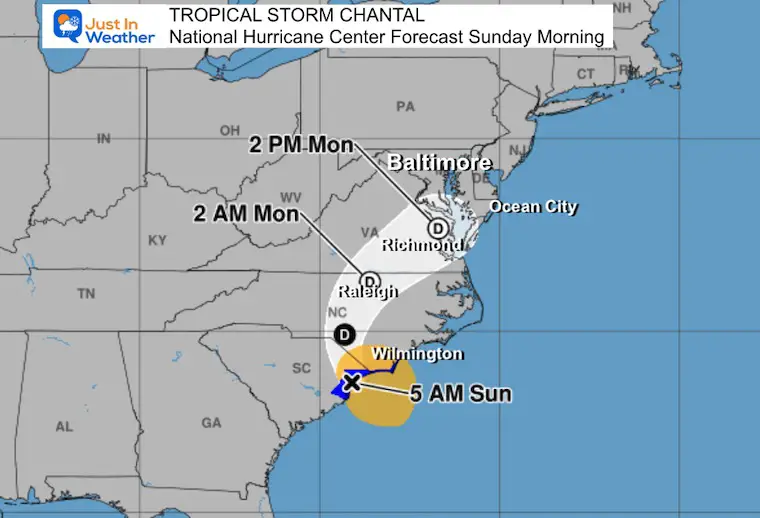
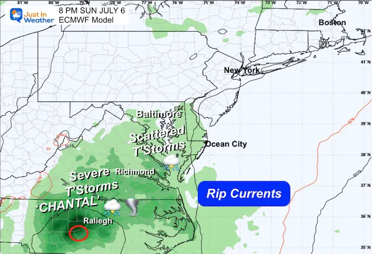
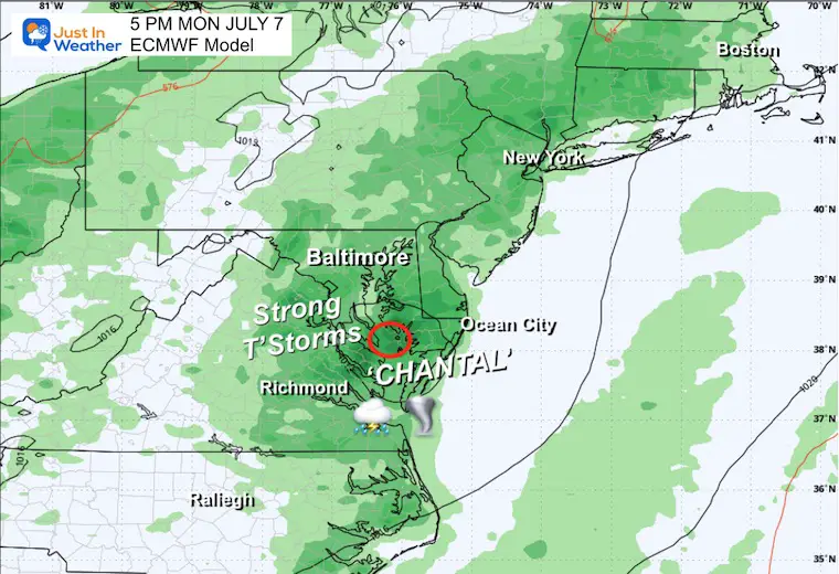
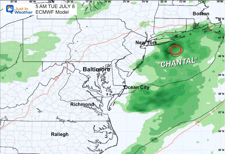
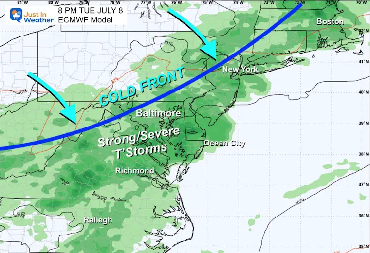
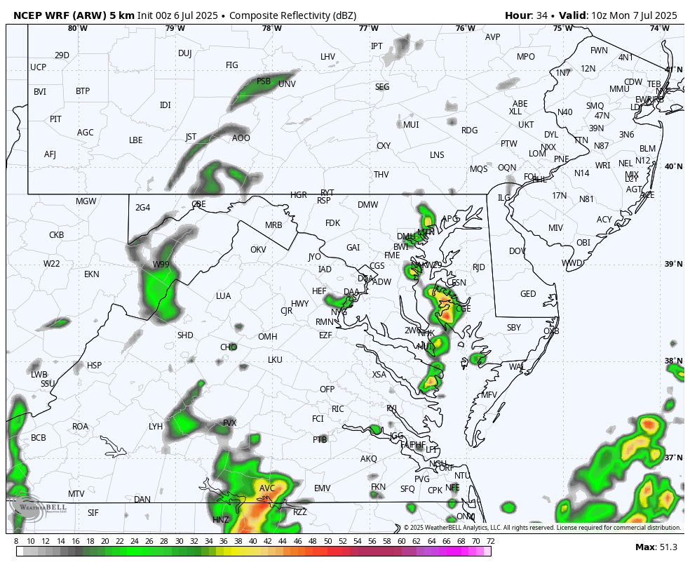
Flash Flooding continues along and east of the path with heavy rain bands. The core Low will weaken to a tropical depression and pass through Southern Maryland on Monday. This will open more humid air to interact with an approaching cold front that may have a wider reach of severe storms on Tuesday.
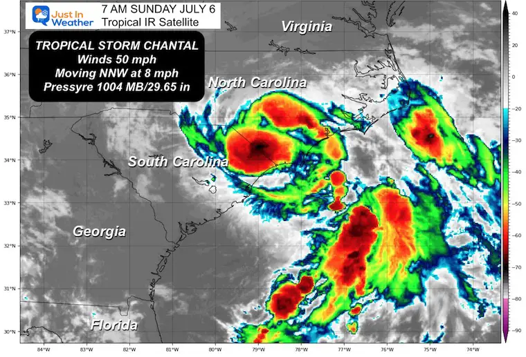
Tropical Satellite at 7 AM Sun July 6
Top winds were 50 mph.
Tropical Storm force winds reach 115 miles from the center.
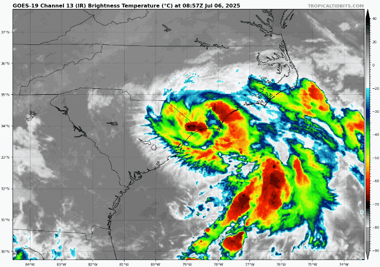
Satellite Loop
Surface Weather

Live Radar and Lightning Widget
National Hurricane Center Forecast Track
Wide View Surface Weather
TS Chantal will bring tropical humidity north as a cold front will arrive from the Northern Plains. While Chantal will move off the coast as a weakened system tomorrow, the next system may produce a wider range of thunderstorms on Tuesday.
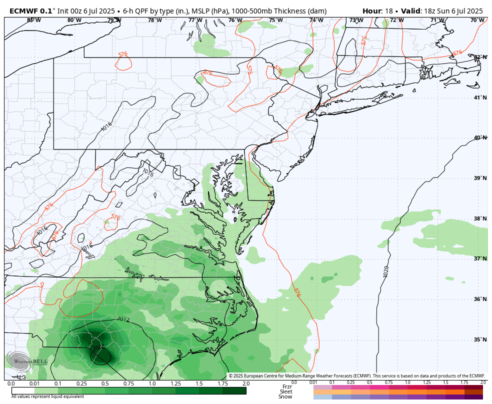
Forecast Model: ECMWF
Sunday Afternoon to Tuesday Evening
Snapshots
Sunday Night
Monday Afternoon
Tuesday Morning
Tuesday Night
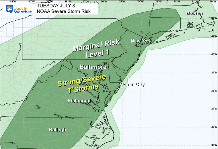
NOAA Severe Storm Risk Tuesday
LOCAL LOOK
CLIMATE DATA: Baltimore
Yesterday: Low 63F; High 87F
TODAY July 6
Sunrise at 5:47 AM
Sunset at 8:36 PM
Normal Low in Baltimore: 67ºF
Record 51ºF in 1979
Normal High in Baltimore: 89ºF
Record 105ºF 2010
Rainfall Deficit at BWI
- Ending 2024 = -8.00”
- Since Jan 1 = -1.74”
- We are STILL DOWN -9.74” INCLUDING LAST YEAR
Subscribe for eMail Alerts
Radar Simulation Noon to Midnight
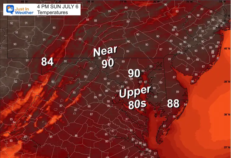
Afternoon Temperatures
MONDAY
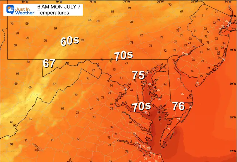
Morning Temperatures
Radar Simulation 6 AM to 8 PM
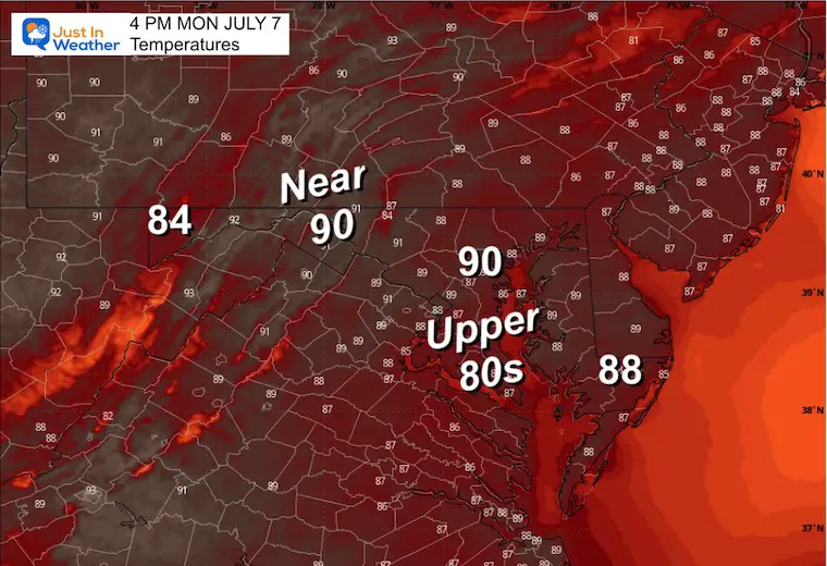
Monday Afternoon Temperatures
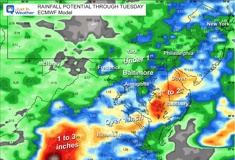
Rainfall Potential Through Tuesday
This is a suggestion. There is a potential for isolated spots that may receive higher amounts.
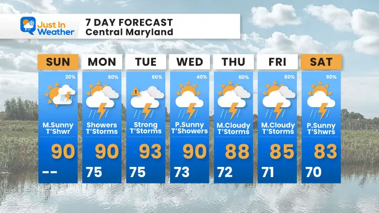
7 Day Forecast
Daily showers and thunderstorms are likely.
While the remains of Chantal will pass through Maryland Monday, a more widespread potential for strong to severe storms may be on Tuesday with the cold front.
Subscribe for eMail Alerts
Please share your thoughts and best weather pics/videos, or just keep in touch via social media.
THANK YOU:
Baltimore Sun Magazine Readers Choice Best Of Baltimore
Maryland Trek 11 Day 7 Completed Sat August 10
We raised OVER $111,000 for Just In Power Kids – AND Still Collecting More
The annual event: Hiking and biking 329 miles in 7 days between The Summit of Wisp to Ocean City.
Each day, we honor a kid and their family’s cancer journey.
Fundraising is for Just In Power Kids: Funding Free Holistic Programs. I never have and never will take a penny. It is all for our nonprofit to operate.
Click here or the image to donate:

RESTATING MY MESSAGE ABOUT DYSLEXIA
I am aware there are some spelling and grammar typos and occasional other glitches. I take responsibility for my mistakes and even the computer glitches I may miss. I have made a few public statements over the years, but if you are new here, you may have missed it: I have dyslexia and found out during my second year at Cornell University. It didn’t stop me from getting my meteorology degree and being the first to get the AMS CBM in the Baltimore/Washington region. One of my professors told me that I had made it that far without knowing and to not let it be a crutch going forward. That was Mark Wysocki, and he was absolutely correct! I do miss my mistakes in my own proofreading. The autocorrect spell check on my computer sometimes does an injustice to make it worse. I also can make mistakes in forecasting. No one is perfect at predicting the future. All of the maps and information are accurate. The ‘wordy’ stuff can get sticky. There has been no editor who can check my work while writing and to have it ready to send out in a newsworthy timeline. Barbara Werner is a member of the web team that helps me maintain this site. She has taken it upon herself to edit typos when she is available. That could be AFTER you read this. I accept this and perhaps proves what you read is really from me… It’s part of my charm. #FITF