A couple tweaks in the data regards to the timeline of storms today have been apparent this morning. Let’s dive into what you should expect in regards to severe storms later today.
Timing
Let’s get to the most important factory first, the timing. The biggest difference between yesterday and today in the data is that storms look to be arriving a little earlier. This means that some storms will be able to tap in to an untouched environment with high levels of instability.
A lot of the early afternoon is dry other than a few scattered downpours. Why is this important? This allows the atmosphere to continue to build instability through warmth. Most data doesn’t show a ton of widespread rain to help limit the about of storm energy we can build up today.

What we need to watch for are any storms that try to develop in front of the main line of strong storms later this evening. Some HIRES data continues to show supercells (rotating thunderstorms) that could pop-up in our area as early as 3-6PM. If this does occur, these storms would have access to an untouched environment and would have a higher tornado threat with them, if they have enough access to that instability. A lot of it will come down to whether or not we will have enough storm energy built up by then at the surface to allow them to become severe.
The issue with the data is that these supercells developing ahead of the main line of storms are not a guarantee. There is a “cap” in the atmosphere that could act as a lid and suppress storms from developing ahead of the main line this evening. If that were to occur, we wouldn’t see many, if any, cells ahead of that main line. Those that would form and not break a cap mid-afternoon could be mainly elevated and produce more hail than a tornado threat. There has to be enough unstable air and lift to break through that cap.
Still, the best chance for widespread severe weather is along the main line of thunderstorms this evening. There is also a new timeline with this part of the storm.
Data this morning has that line reaching our western communities between 6PM-8PM this evening.
That line should reach Louisville more between 8PM-11PM tonight.
With these storms speeding up more, most of the severe weather threat should be gone from our entire area by around 1AM.
Severe Threats
With these storms comes all modes of severe weather. In order to get that, we need instability (CAPE), moisture, and wind energy.
When we look at the storm energy available for this afternoon and evening, you’ll notice the really bright colors to our west, but still relatively high values across the Louisville area as well heading into the evening.
Any strong storms that could arrive before that main line tonight could take some storm energy out of the atmosphere. Wherever storms haven’t been by the time the main line gets here will have the higher severe risk.
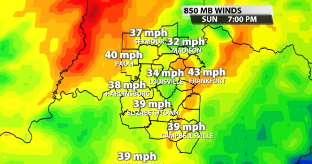
Our wind energy is still right on the threshold of being supportive enough for severe weather. The numbers are not astronomical, but it is still just enough to support strong storm convection.
The Storm Prediction Center still has a level 3/5 “Enhanced” risk out for our area today.
When we break down the specific threats, the biggest one is by far the damaging wind threat. The SPC currently has a high, 45% risk out for damaging wind gusts over 58mph across our entire area for tonight.
In terms of our tornado threat, it still remains conditional, but still a threat that needs to be monitored. The SPC has what we call a “hatched” 10% risk over our area. This hatched area signifies the chance for “strong” (EF2+) tornadoes within the highlighted area.
Have a way to get warnings today & tonight in case one is issued for your area. We will also have to monitor what looks like a very powerful system heading in our direction for Wednesday.
Reach meteorologist Bryce Jones at [email protected], on Twitter or on Facebook. Copyright 2025. WDRB Media. All rights reserved.