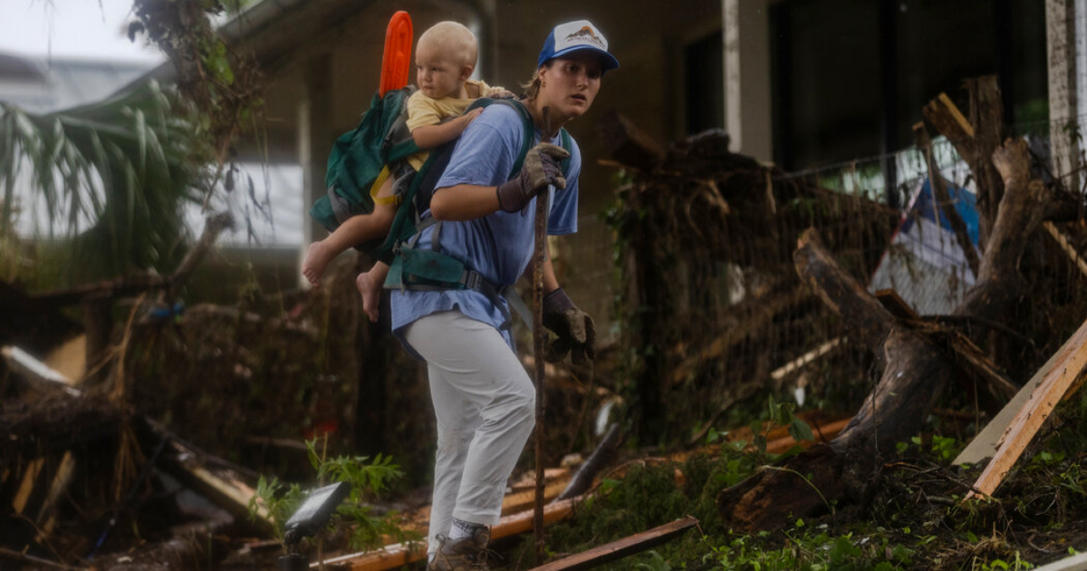
Jason Runyen, a meteorologist at the Weather Service’s office for Austin, San Antonio and the surrounding areas, said that while river levels across the region had receded, more rain could exacerbate flooding in the area. Flash flooding in the region killed more than 50 people over the weekend, with dozens more missing.
“We’re kind of saturated now,” he said. “So any additional amounts, even if we don’t get up to 10 inches, could cause flooding.”
The Weather Service’s Storm Prediction Center placed a Level 2 out of 4 risk for flash floods over portions of North and Central Texas and the Hill Country through Monday afternoon.
Further rounds of heavy rain were expected at the beginning of the week before drier conditions develop. “There’s still chances of daily precipitation in the forecast on Monday and Tuesday,” Mr. Runyen said. “It trends drier and warmer beyond Tuesday.”
The flooding that began on Friday was triggered by a combination of a moist tropical air mass — the remnants of Tropical Storm Barry — and a slow-moving storm system, which together fueled powerful thunderstorms.
Mr. Runyen said that the storms occurred in two separate waves: one Thursday night into Friday morning, and the other Friday night into Sunday morning.
Ahead of the storms, the Weather Service issued a broad flood watch for parts of south-central Texas, including Kerr County, specifying the possibility of rainfall totals up to three inches and isolated amounts of five to seven inches. But for some areas, the actual totals far exceeded those projections.
“Most areas were between five to 10 inches,” Mr. Runyen said. “But there was a little pocket of eight to 12 inches, that exceeded our values in our flood watch,” he added, referring to areas near the Guadalupe River where many people were killed.
Texas officials appeared to blame the Weather Service for forecasts on Wednesday that underestimated the amount of rain that was coming. Former Weather Service officials have said that the forecasts were as good as could be expected, given the way the storms escalated and the remarkable levels of rainfall. Some experts questioned whether staffing shortages at the Weather Service also made it harder for the forecasting agency to coordinate with local emergency managers as floodwaters rose.
In the early hours of Friday morning, a “particularly dangerous situation” warning was issued for Kerr County, highlighting communities along the Guadalupe River as high-risk areas. Rainfall estimates in this swath were for five to 10 inches.
Other counties, such as Tom Green County, were also placed under similar warnings Friday morning as heavy rain fell.
Later on Friday, another intense round of rain battered the region. A new flood watch was issued, including portions of the Hill Country, warning of isolated rainfall totals up to 10 inches. Again, this amount was exceeded. Up to 16 inches of rain fell in Kirby, southwest of Austin, from Friday into Saturday, Mr. Runyen said.
The deluge caused rivers in the region to rise to major flood stages. The Guadalupe River reached 29.45 feet — its second highest level on record, surpassing the levels that led to the devastating flood of 1987 in the same area, according to the Weather Service.
The actual river levels this weekend might have been even higher than recorded, however, according to Mr. Runyen, who said that the river gauge was “washed out” during the storm.
“We think that may have been a record,” he said.
Flooding also occurred north of Kerrville, in San Angelo, where a National Weather Service office had issued river flood warnings on Friday for all parts of the San Saba, Concho and Colorado rivers.
A flash flood emergency was declared for the Llano River in Mason County early Friday afternoon due to rapid rise. The warning urged residents, “If you live along or near the river in this area, take action immediately as this is a life-threatening situation!” The San Gabriel River also experienced flooding.