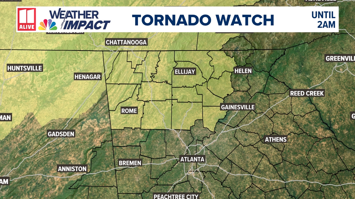
ATLANTA, Georgia — A tornado watch is in effect until 2am for much of north Georgia. Atlanta is not included in the watch at this time. This watch includes Dade, Walker, Catoosa, Chattooga, Cherokee, Dawson, Fannin, Forsyth, Gilmer, Lumpkin, Pickens, Union, Bartow, Floyd, Gordon, Murray and Whitfield counties.

We are issuing a Weather Impact Alert for strong and severe thunderstorms Tuesday night. It is important to note that this appears to be an overnight system and most people will be sleeping.
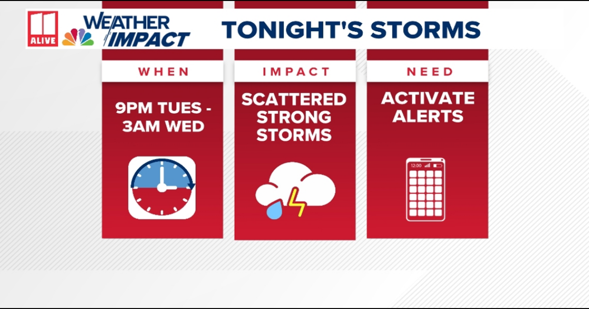
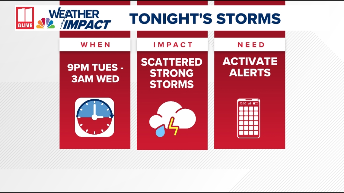
WHEN: Tonight 9 p.m. to Wednesday 3 a.m.
IMPACT: Strong to severe overnight thunderstorms
NEED: Have multiple ways to get warnings while you are sleeping

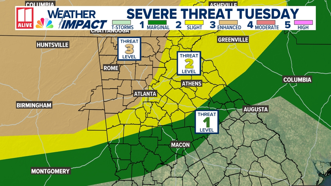
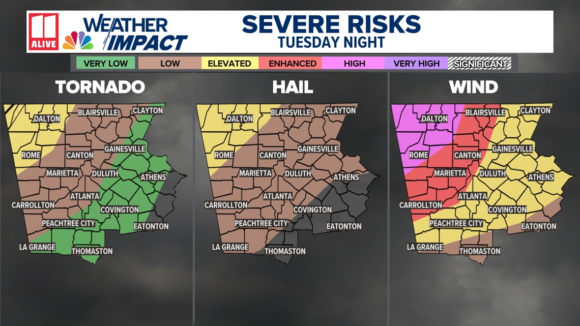
The Storm Prediction Center has expanded the level 3 threat (enhanced risk) to include the Northwest half of the Atlanta metro area. There is a level 2 threat (slight risk) for severe thunderstorms over our southeast Metro, and a level one threat (marginal risk) for central Georgia.

A significant threat of damaging winds is likely this evening and overnight, with some gusts 60 – 70+ mph possible. There is also a chance of a brief spin-up tornado, with that threat most likely in northwest Georgia. Storms will bring in heavy rain, frequent lightning, and hail is possible.

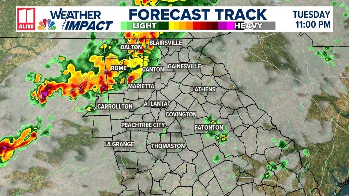
Storms have been working into northwest Georgia early tonight. The line will be moving closer to the northwest side of the metro between 11:30 and 1 a.m.

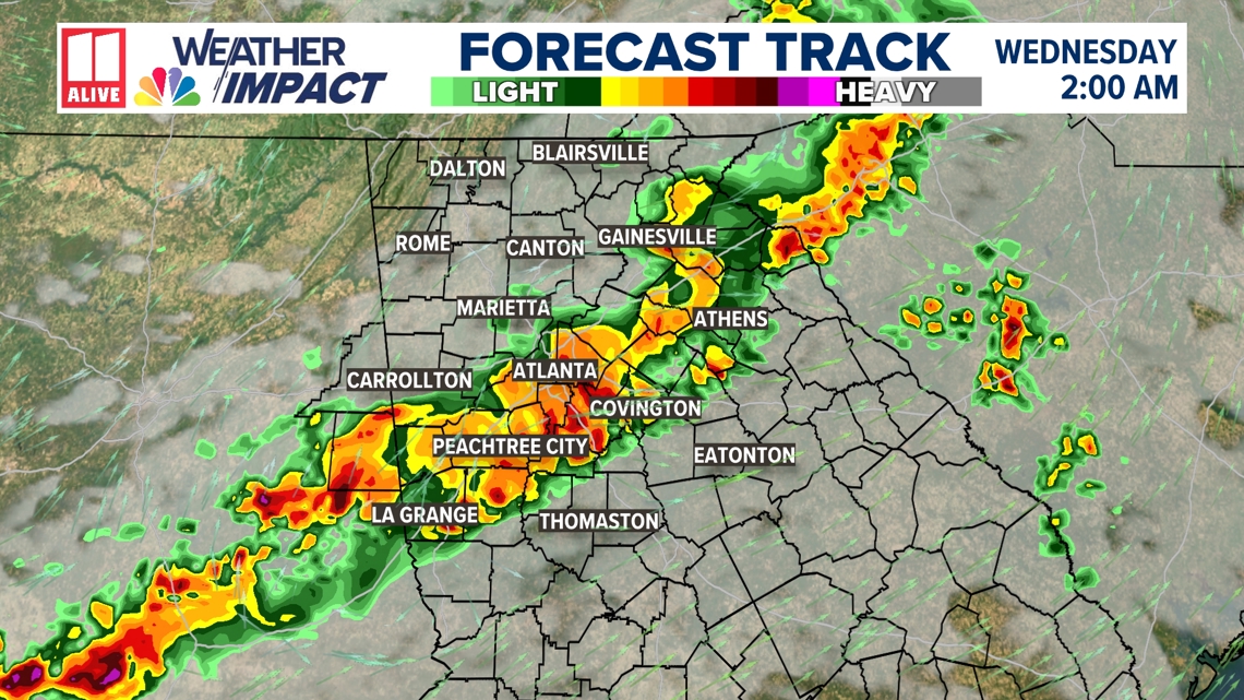
After 1 a.m. is the time when the southeast side of the metro area will be experiencing the pockets of heavy rain and the severe threat. As you can see, the line shows signs of weakening in the overnight hours as we lose some heating.

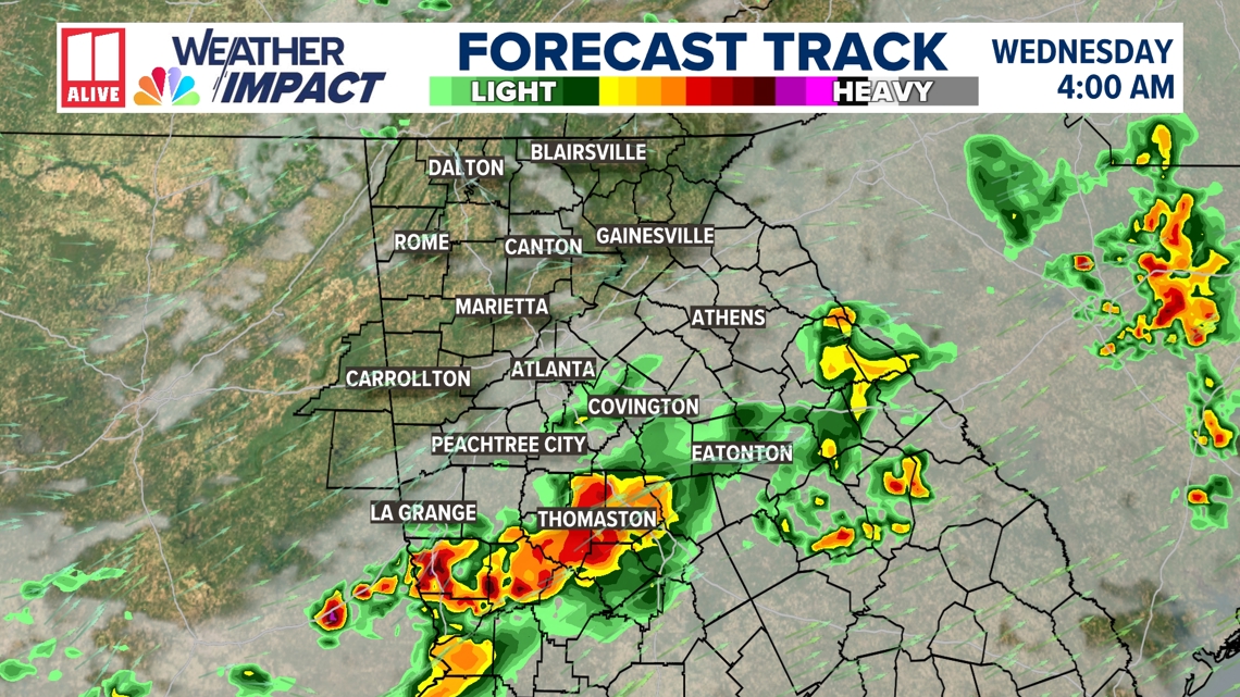
By 4am, most of the rain and storms have largely moved to the southeast. The last of the showers and storms should be exiting around then.

Stay weather-aware on Tuesday, especially if you live in north Georgia. Keep an eye on updated forecasts and be prepared to adjust your plans if storms threaten your area.