After severe thunderstorms damaged parts of Kentucky overnight Sunday into Monday, more severe weather is expected later this week, according to the National Weather Service.
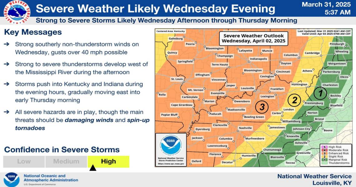
The first round of severe weather is expected to arrive Wednesday. The NWS said strong to severe thunderstorms will develop west of the Mississippi River in the afternoon and make its way through Kentucky beginning Wednesday evening.
All hazards are in play with the storm, particularly 40 mph wind gusts and spin-up tornadoes, according to the NWS. Weather models show an 80-90% confidence of wind gusts exceeding wind advisory levels along the Interstate 64 corridor.
A wind advisory indicates sustained winds of 30 mph for one hour and/or frequent gusts of at least 45 mph, according to the NWS.
Most of Kentucky, including Lexington, is in the enhanced risk zone of the storm’s outlook, while areas farther east are in the slight or marginal risk zone. The biggest threat for severe weather is along and west of I-65, according to the NWS.
More severe weather is possible Thursday, depending on how Wednesday’s storms evolve, the NWS said. Confidence in Thursday’s storms is lower and the NWS puts the chances for severe weather then between 15-29%.
If you are dealing with storm damage on private property in Fayette County, it’s up to the property owner to clear the debris. Storm damage on public property can be removed by calling LexCall at 311 or submitting a service request online through the city’s website, which will create a work order.
The city only picks up limbs on public property, such as on a city street. City residents should dispose of downed limbs in their gray yard waste bin.
Excess rainfall increases chance of flooding
Excessive rainfall from the upcoming storm is increasing the chance of flooding later this week.
Some of the farthest western Kentucky counties could get more than 10 inches of rain throughout the week, and widespread minor to moderate flooding is possible.
The NWS’ excessive rainfall outlook puts parts of Western Kentucky in the moderate risk zone (at least 40%) for flooding Wednesday. On Thursday, the zone expands to include all of Kentucky’s northwestern counties bordering Illinois, Indiana and Ohio. The risk decreases to the slight risk zone (at least 15%) Friday but expands to include most of the state.
Weather models show a high confidence for unusually high precipitation Thursday, Friday and Saturday, the NWS said. The greatest probabilities for flooding are along the Green River as well as southern Indiana rivers.
This story was originally published March 31, 2025 at 12:33 PM.