CHANHASSEN, Minn. — Dark and ominous skies hung over most of central and southern Minnesota Monday morning with plenty of lightning and heavy rain in some spots, the first wave in what promises to be a rocky day of weather.
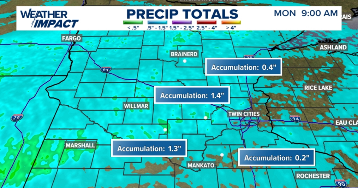
KARE 11’s John Zeigler says the fast-moving line of storms dropped nearly an inch and a half of rain on areas just west of Minneapolis St. Paul, and northwest of Mankato. Plenty of lightning was also indicated, but things never reached the threshold of being severe.
Zeigler says the line rolled in from South Dakota Monday morning, straight west to east. This line is expected to exit Minnesota around 10 a.m., and there should be a dry period until 2 p.m. or so.
It’s what happens during that dry period that will determine just how severe the second round of storms is. Zeigler expects them to pass through from 3:30 to 6:30 p.m. and says if skies clear and the sun comes out, early afternoon temps could climb near 80 degrees. That would give the second wave of storms the energy to develop tornadoes, large hail and damaging winds.
The worst of the cells later today should set up in the southern part of the moderate threat. pic.twitter.com/DIcgxc7qkJ
— Meteorologist John Zeigler (@JohnZeiglerWX) April 28, 2025
Models suggest that the greatest chance for strong tornadoes will be in southern Minnesota.
“The most dangerous period is likely during the late afternoon and evening when strong tornado potential should be maximized. Scattered large to very large hail and damaging winds are likely as well,” meteorologists at the Storm Prediction Center in Norman, Oklahoma, wrote.
Depending on how the storms form, tornadoes in the EF-2 range or greater are possible, the weather service office for the Minneapolis area said.
Stay with KARE 11+ for the latest on Monday’s Weather Impact Alert.