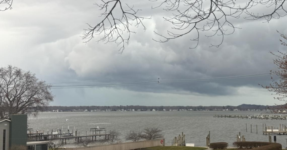
MICHIGAN, USA — The 13 Weather Impact team is tracking severe weather moving across West Michigan Sunday afternoon and evening.
Multiple tornado warnings and severe thunderstorm warnings were issued, but have since expired.
Around 6:15 p.m., 13 ON YOUR SIDE Meteorologists tracked a potential tornado with debris in Montcalm County. The National Weather Service will need to conduct a survey to determine if the damage is consistent with a tornado.
Winds as strong as 80 mph rolled through the area, knocking down tree limbs, downing power lines, damaging roofs and causing extensive power outages.
Beach Elementary School in Muskegon will be closed Monday due to roof damage and flooding.


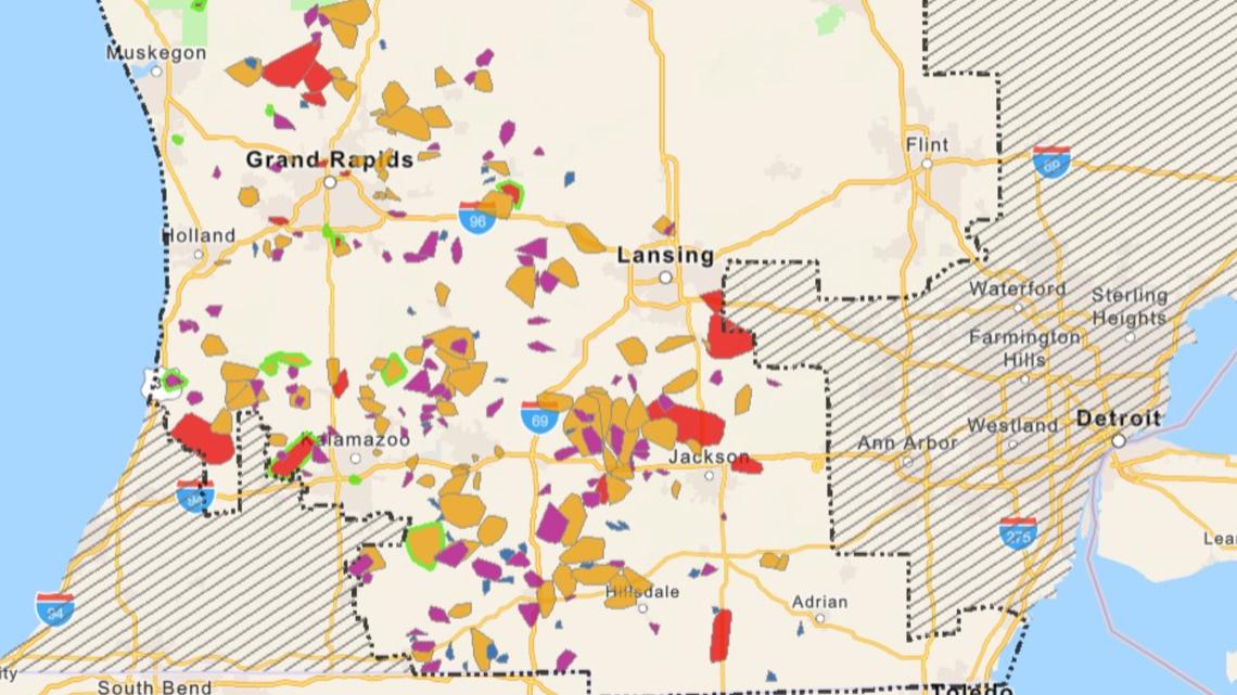
There are widespread power outages across West Michigan as a result of the storms.
The Consumers Energy Outage Map reports about 189,600 customers without power as of 11:45 p.m. Sunday. That number decreased to about 167,000 people without power by 6 a.m. Monday.
Consumers Energy said earlier on Sunday that there are more than 600 crews across the state working to restore the outages.
Spokesperson Brian Wheeler said it’s important for customers to remember to watch for downed power lines and stay away from them, as well as watch out for Consumers Energy crews at work.
“You’re going to see crews in the middle of the road, working along the side of the road, even in the middle of the night. So just drive slowly. Be aware of your surroundings,” he said.

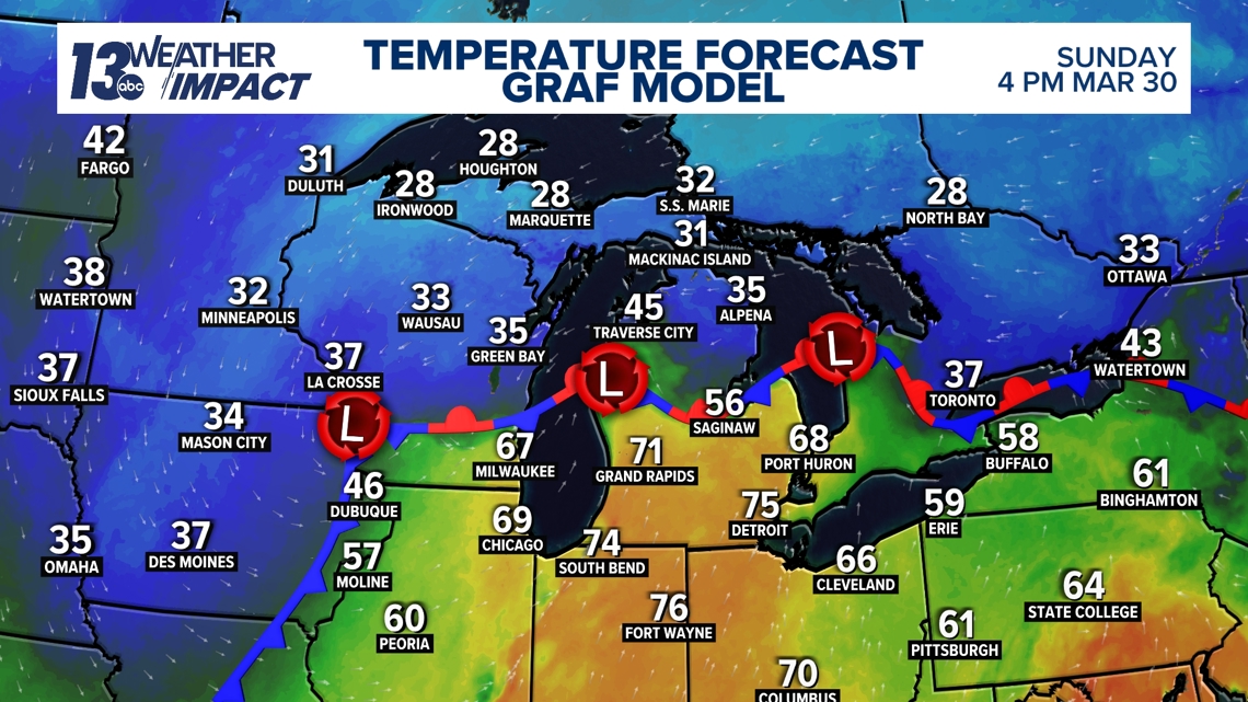
The stationary front that stalled out over northern Michigan has left us with large temperature variations from north to south and scattered showers through Sunday morning. Southerly flow will drive the stationary front further north, ushering in warmer temperatures and higher dew points Sunday afternoon.
This will help set the stage for severe weather potential in the afternoon hours.

A few non-severe thunderstorms are expected mainly north of Grand Rapids late Sunday morning into the early afternoon.
We could see a lull in rain and storms in the early afternoon, with the possibility of clouds breaking a bit, mainly closer to I-94. Any sunshine that we see coming through the cloud deck will work to increase temperatures and further destabilize the atmosphere.

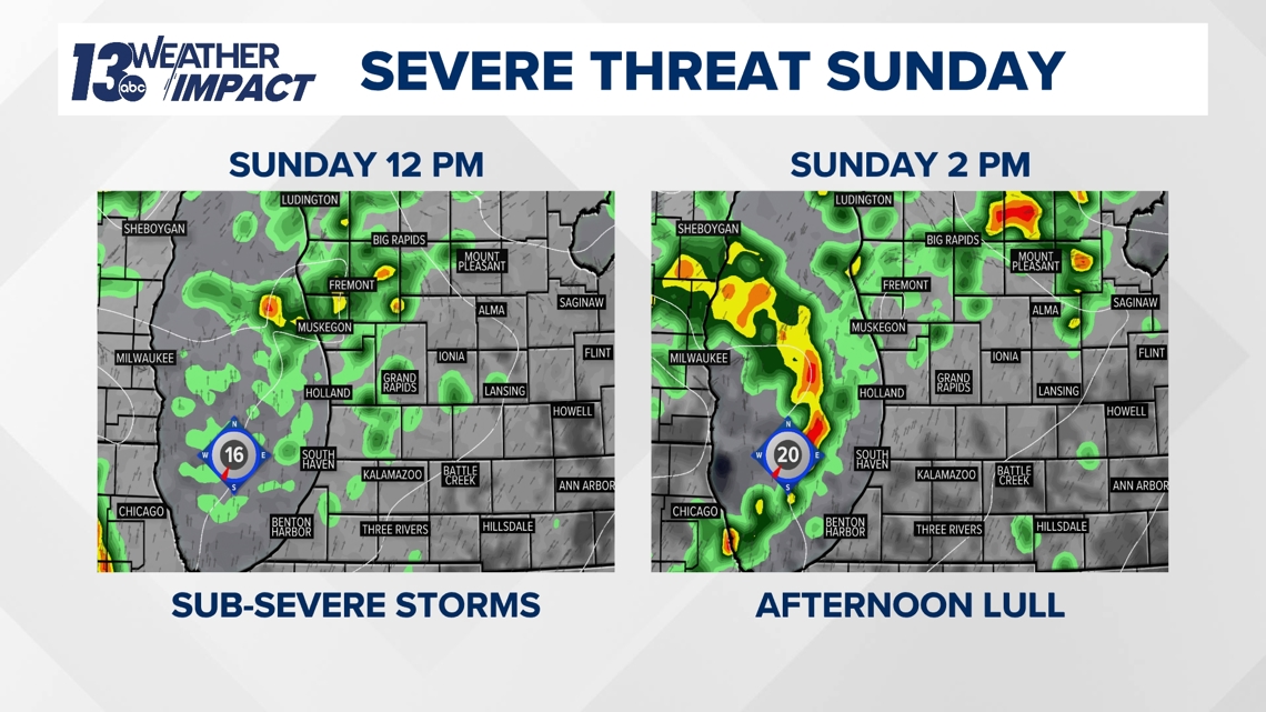
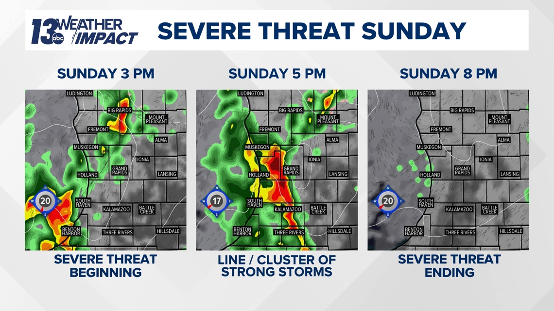
A strong cold front sweeps across the region Sunday evening, lofting the warm, relatively moist air upwards and generating thunderstorms in the process. A clustered line of storms moves in Sunday evening between 3 PM and 4 PM to southwest Michigan, moving east-northeast.
Strong to severe storms along the line continue through the evening, moving out between 7 PM and 8 PM for most. The threat of severe weather clears the area by 8 PM Sunday night.

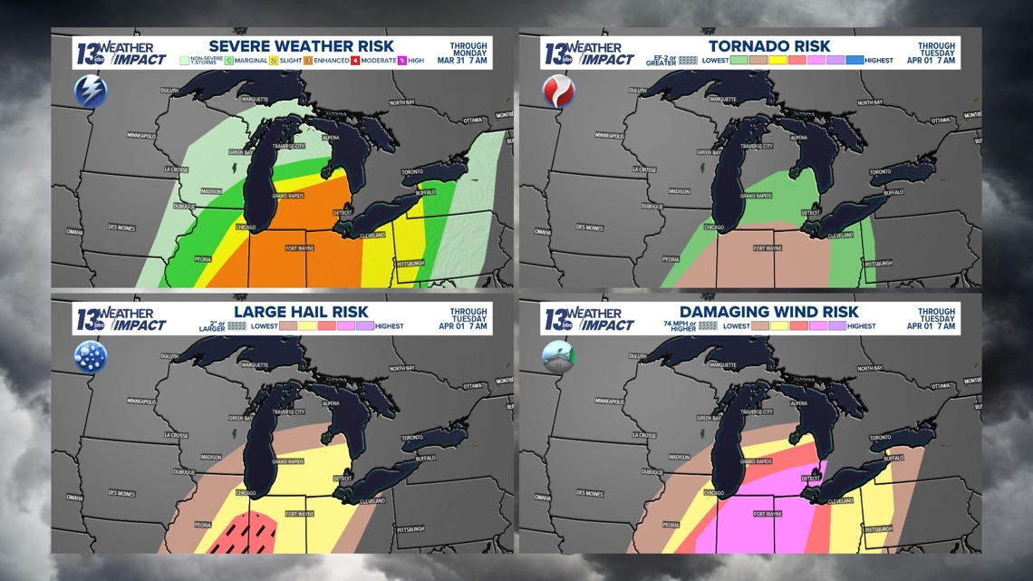
During this timeframe, the main concerns are gusty winds and hail.
The cold front itself is likely to bring strong gusts, potentially exceeding 40 mph as it passes through West Michigan, but stronger thunderstorms could bring localized gusts over 60 mph that could result in scattered power outages.
In addition to wind and hail, there is also a chance for isolated tornadoes.

Those that live south of a Grand Haven-to-Greenville line will see the greatest chance for severe thunderstorms to materialize.
Stick with the 13 Weather Impact team for more updates throughout the weekend.