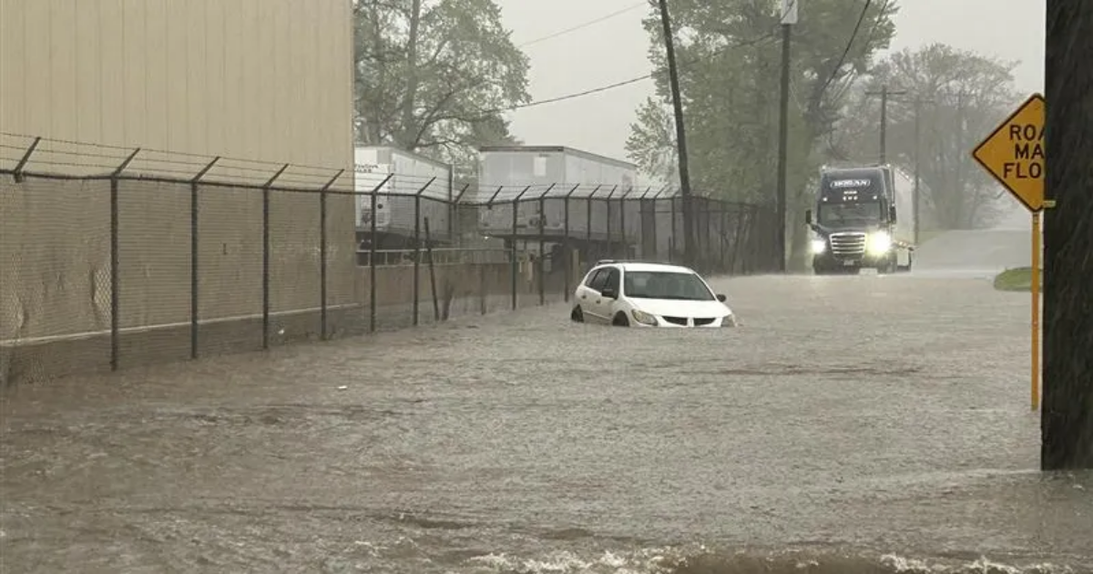
A deadly string of storms hit Tennessee Wednesday night and the rain isn’t expected to stop for several more days, leading to concerns for a “generational flooding” event.
Concerns over flooding in West and Middle Tennessee are part of “a multi-day catastrophic and potentially historic heavy rainfall event,” the National Weather Service said earlier this week. The event is expected to bring floods that are only experienced once in a generation or a lifetime, but for those in Nashville, it may be a twice-in-a-lifetime event.
In 2010, the metro area was inundated with more than 9 inches of rain in a 24-hour period, setting a new record and causing devastating flood waters that many still remember 15 years later.
What happened during the May 2010 flood?
The flooding that hit the Nashville area and Middle Tennessee in 2010 set the record of how much rain came down in the area and how high rivers crested during the height of the storm that May. The National Weather Service called it an event “rarely seen”.
Over a two day period, 13.57 inches fell on May 1 and 2 in Nashville. A day later, the Cumberland River hit its highest peak during that storm event, causing catastrophic destruction throughout the community.
During the flooding, the Cumberland River at Nashville rose to 52.55 feet on May 3, just short of the highest crest on record – 56.20 feet, according to the National Weather Service. That record was set in 1927, before dams controlled the flow of the Cumberland and its tributaries.
At the time, the U.S. Army Corps of Engineers speculated that if the dams hadn’t been there, the 2010 flood could have come close to or exceeded 56 feet in downtown Nashville.
In Clarksville, the Cumberland River exceeded 60 feet, beating out the previous record crest of 57.10 feet set in the 1979 Flood.
Why was the 2010 flood so bad?
Like in recent flooding events caused by Tropical Storm Helene in East Tennessee and Western North Carolina, flood events on this level have multiple causes. But the biggest issue is vast amounts of rain coming down in multiple areas and the water that naturally runs into the rivers and streams having little or no place to go but up and out of their banks.
The high Clarksville saw in 2010 happened due to significant inflows from two major tributaries – the Red River and Harpeth River, according to the weather service.
Rivers, creeks start hitting highs as rain pours down
Fast forward to 2025, and the threat of flooding is at an all-time high as the number of inches of rain already accumulated creeps upward.
Officials area already keeping a close eye on rivers and creeks in Middle Tennessee.
Tony Lance, who works at the Tennessee Wildlife Federation’s office off White Bridge Pike near Richland Creek, estimated the creek likely hit more than 10 feet above its normal height on Thursday morning.“This is the highest we’ve seen the creek since the big flood … 2010,” Lance said. “It hasn’t been that high since.”
Currently, officials are watching the Cumberland, Red, Duck and Buffalo rivers, and expect waterways to reach their crest sometime on Friday.
As of Thursday afternoon, reports from forecasters and officials have the Cumberland River in Dover expected to crest near 66 feet. The record is 69.33 feet in 2019.
Nashville flooding: Cars, dumpsters, debris swept away
In the metro area, pictures have popped up of cars lost in a lake that once was a parking lot, dumpsters floating away and debris being swept down stream by the Cumberland River.
Nashville International Airport has reported 2.02 inches of rain in the last 24 hours, and the area is expected to see upward of 6 inches of rain by the time this event is over.
While it might seem like the worst is already behind the area, people need to remain vigilant and cautious when it comes to rising water levels as heavy rain continues to come down through the weekend, especially near bodies of water and also in urban areas.
You can keep an eye on river heights and potential flooding in areas in Middle Tennessee here.
What is a 1,000-year flooding event and how likely is it to occur?
Events that are predicted to be once in a lifetime or a once in 1,000 year event does have data behind the likelihood of an event happening.
According to the weather service, a 100-year flood is an event that statistically has a 1% chance of occurring in any given year. The higher the number the less likely, statically speaking, it is to occur. So, for a 500-year flood event there is a 0.2% chance of occurring and a 1,000-year flood has a 0.1% chance of occurring.
What does ‘generational flooding’ mean?
The National Weather Service out of Memphis referred to these storm systems’ potential to bring “generational flooding” to the area.
This usually refers to an event that usually only happens once in a generation…or a once-in-a-lifetime event.
People in East Tennessee and western North Carolina saw similar flooding after Tropical Storm Helene dumped massive amounts of rain in those communities, which caused rivers to crest to historic levels and cut a swath of destruction that has forever changed those communities.
When is the rain expected to stop?
The National Weather Service predicts that the rain will continue into the weekend, and the chance of flooding will remain.
A low-pressure/frontal system is predicted to become nearly stationary across the region on Thursday, leading to the risk of significant heavy rainfall totals, forecasters say.
The front will remain stalled into the weekend, bringing historic rainfall totals to the area, with some locations seeing a potential for more than 10 inches of rain through the weekend.
The weather service has issued a flood warning for the area until Sunday, April 6.
Evan Mealins and Craig Shoupe contributed to this report.
