NASHVILLE, Tenn. (WKRN) — For the third weekend in a row, Middle Tennessee and Southern Kentucky are under a significant severe thunderstorm threat. This time the storms will impact late Sunday night and the early hours of Monday morning.
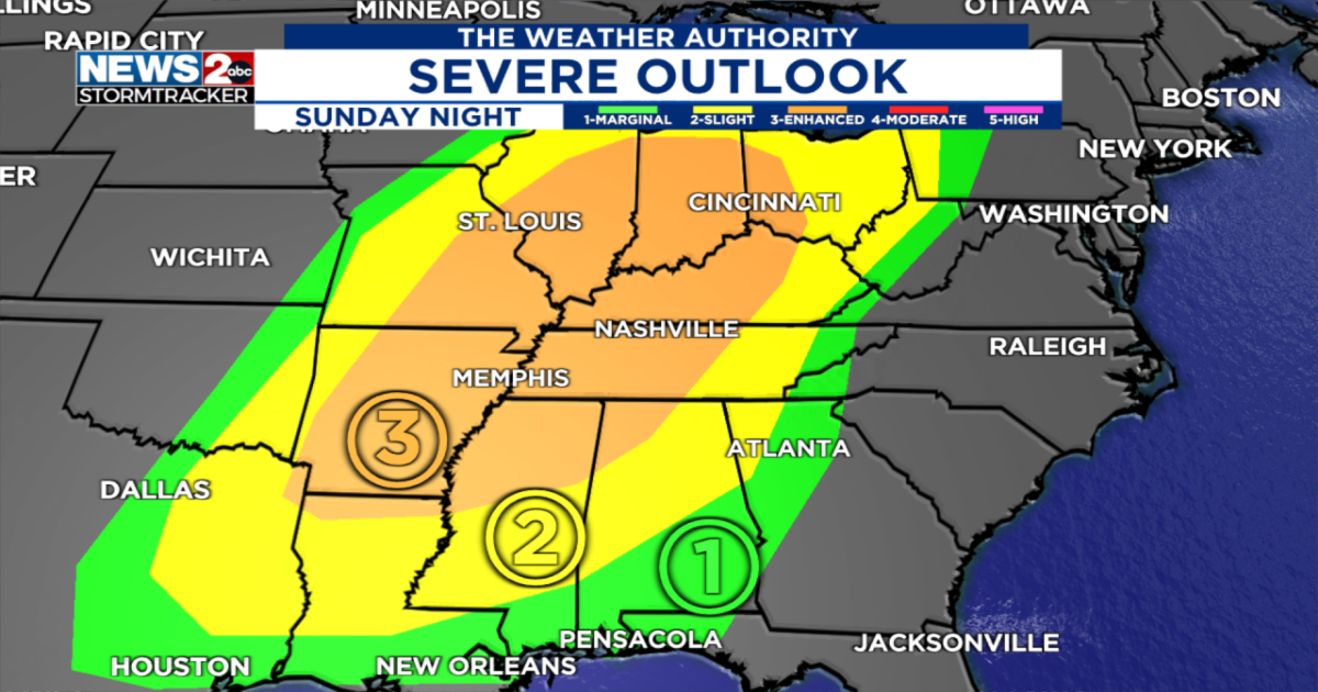
The Storm Prediction Center has issued a huge area where severe weather will be possible. Most of our area is under a level 3 out of 5 enhanced risk. This is a significant threat and could be increased over the next 24 hours.


All modes of severe weather are possible. The strongest thunderstorms could produce wind gusts over 70 mph, hail as large as golf balls and tornadoes. The Storm Prediction Center mentioned the possibility of strong tornadoes, meaning EF-2 or stronger.

What makes this severe threat more dangerous is the fact that it will move through when most folks are sleeping. The storms will begin as early as 9 p.m. for our western counties and last through sunrise on Monday in our eastern counties. Click through the images below for the latest forecast model data.


With these storms moving through at night, it is extremely important that you have a way to receive severe weather alerts like severe thunderstorm warnings and tornado warnings. Download the WKRN Weather Authority app now so you can be weather alert.
It’s too early to get into specifics, but we want to give you an early heads up and let you know that another round of severe weather will be possible on Wednesday.

Stay tuned for updates!
Don’t forget to take the power and reliability of the WKRN Weather Authority with you at all times by downloading the News 2 Storm Tracker app.
Copyright 2025 Nexstar Media Inc. All rights reserved. This material may not be published, broadcast, rewritten, or redistributed.