More rain chances towards the end of the week.
•
Mar 31, 2025, 9:54 PM
•
Updated 1 hr ago
It’s a stormy evening that will give away to fair and cooler weather for the next couple of days. More rain chances towards the end of the week.

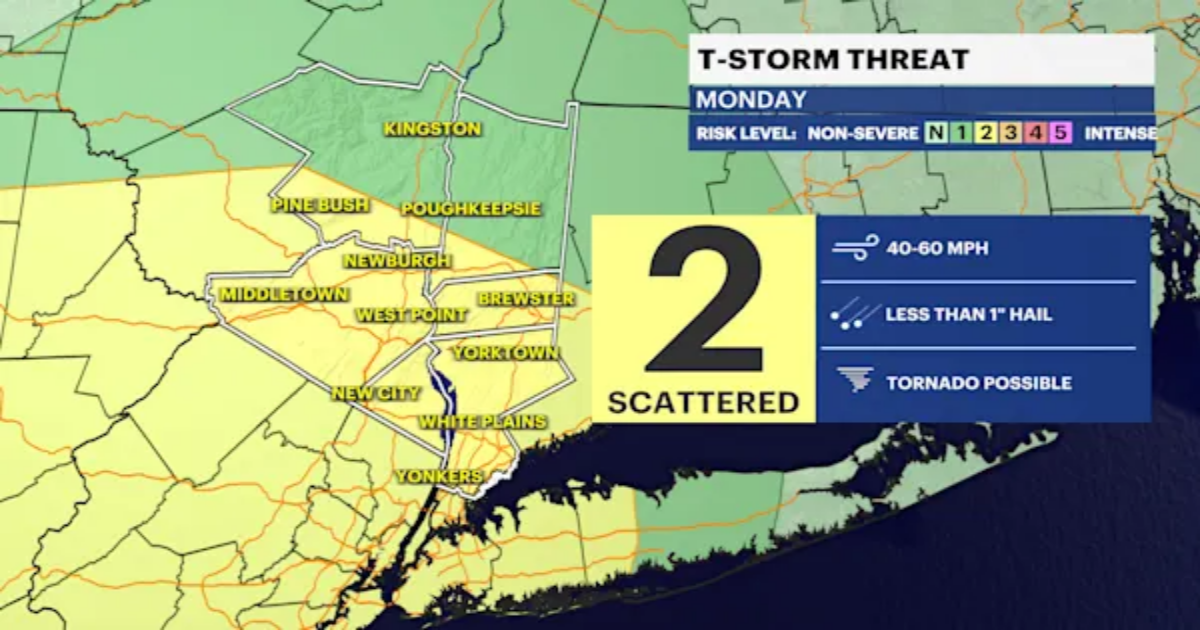
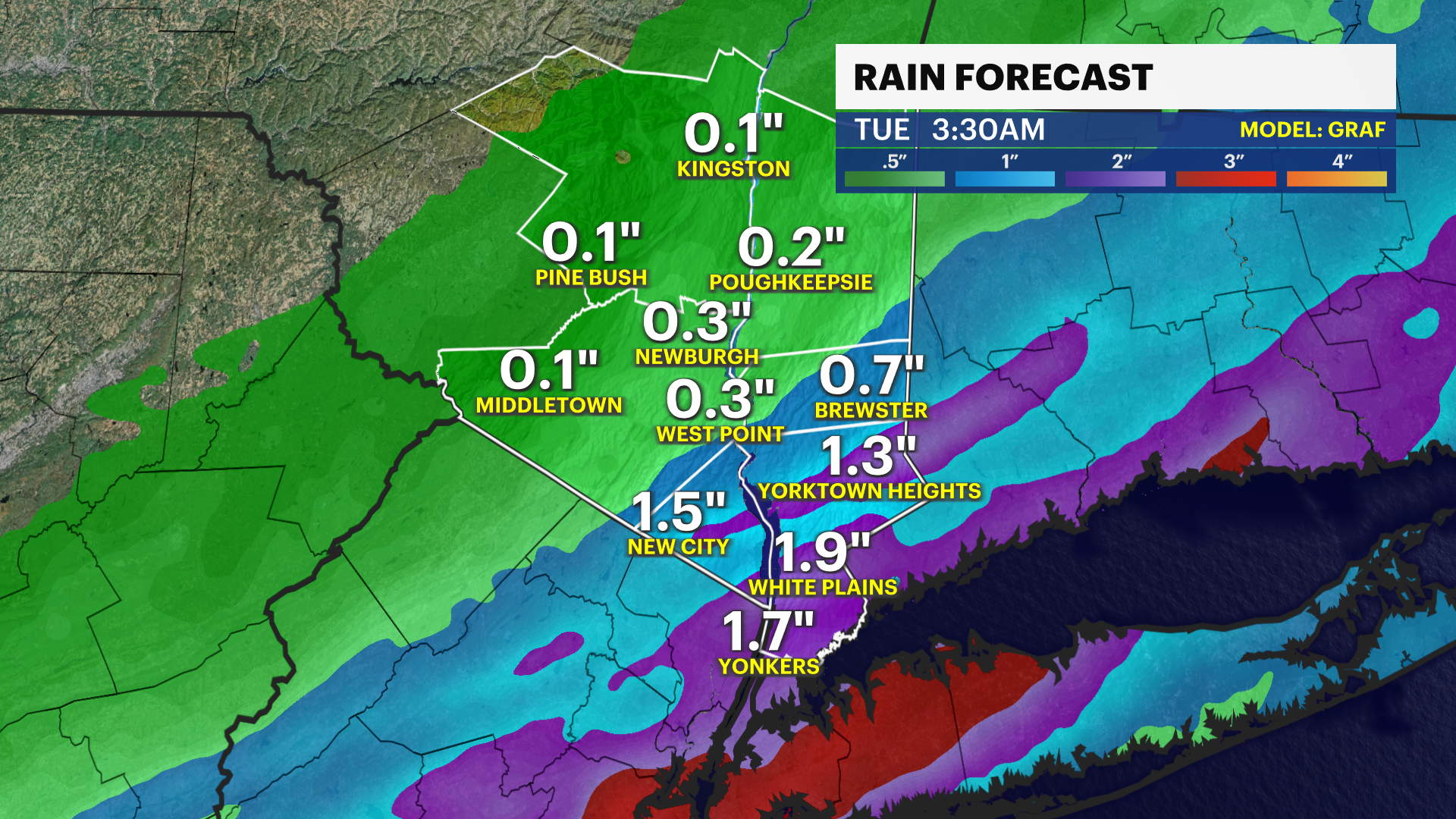
Plan on a rough evening commute today! Heavy rain and strong thunderstorms mostly develop after 5 p.m. and through around 10 p.m. tonight. After that, showers begin to taper off with a gradually clearing sky overnight. Evening storms will bring a risk of damaging wind gusts, especially west of the Hudson River as well as a ponding of water, small hail and frequent lightning. Secure loose outdoor objects before this evening.

Nicer, but windy and cooler weather moves in tomorrow through Wednesday with an unsettled stretch of weather and at least spotty rain shower chances each day Thursday through next Monday.
FORECAST:
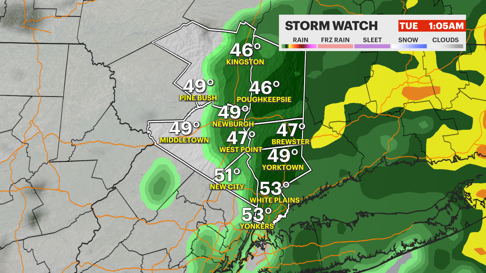
TONIGHT: STORM WATCH — Heavy rain and thunderstorms end by late-evening with a partially clearing sky overnight. Lows near 43 degrees.

TUESDAY: Sun and clouds. Windy and cooler with highs around 54 degrees. Lows near 33 degrees.
WEDNESDAY: Sun gives way to clouds. Chance for a few mixed showers at night. Highs around 49 degrees. Lows near 42 degrees.
THURSDAY: Mostly cloudy with spotty showers possible. Warmer. Highs around 71 degrees. Lows near 55 degrees.
FRIDAY: Mostly cloudy with spotty light showers possible. Not a washout. Highs around 65 degrees. Lows near 44 degrees.
SATURDAY: Mostly cloudy with spotty rain showers likely. Highs around 52 degrees. Lows near 40 degrees.
SUNDAY: Mostly cloudy with a better chance for off and on rain showers. Highs around 55 degrees. Lows near 38 degrees.