by Kevin Coskren
Mon, April 28th 2025 at 6:13 PM
SEVERE MON NIGHT.jpg
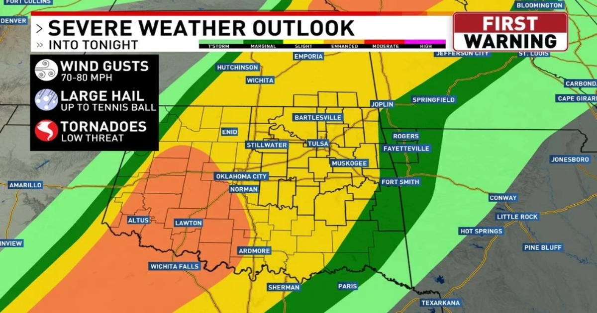
There is an elevated risk for severe storms tonight for much of Green Country. Storms should approach our western viewing area around sunset.
Tonight’s tornado threat is low, but a few tornadoes cannot be ruled out, especially west of Tulsa.
Storms should continue into Tuesday morning.
Periods of rain and storms are likely through the day on Tuesday.
Severe wind/hail and flooding will be a threat across much of Green Country on Tuesday.
The tornado threat on Tuesday will be very low.
Here is a storm snapshot for Tuesday morning.
Heavy downpours are likely with thunderstorms through the day on Tuesday.
Numerous showers and isolated t-storms will be present on Wednesday. A few severe storms cannot be ruled out.
Here is a storm snapshot of Wednesday morning.
Storms will continue into Wednesday afternoon. Watch out for water over the roads.
Showers and t-storms will linger into Thursday morning.
Precip chances are high for the next couple days.
Much of the state will see several inches of rain through Thursday.
A Flood Watch has been issued. Beware of street flooding and river flooding.