BIRMINGHAM, Ala. — A powerful storm system is set to sweep through Alabama late Sunday night, bringing with it a threat of severe weather. According to ABC 33/40 Chief Meteorologist James Spann, the main risk will be from strong, potentially damaging straight-line winds, with some hail also possible. While the highest tornado threat is expected to remain north and west of Alabama, an isolated brief tornado or two cannot be ruled out.
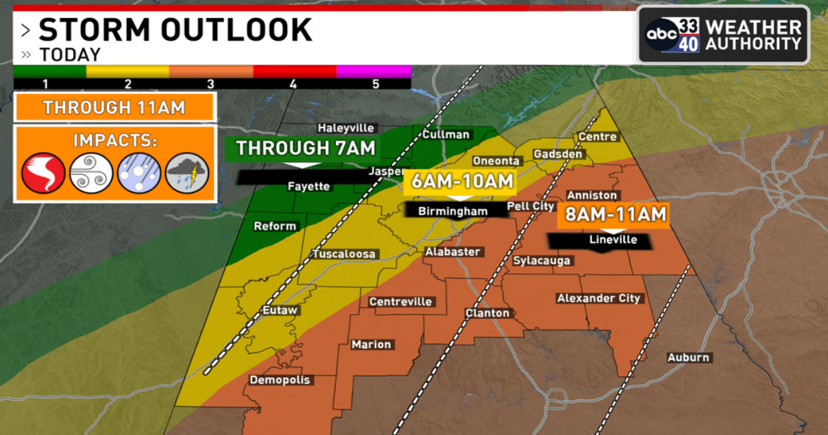
The Storm Prediction Center has placed much of Central Alabama under an “enhanced risk” (level 3 out of 5) for severe thunderstorms. A fast-moving line of severe thunderstorms is expected to move through Central Alabama late Sunday night into Monday morning, with damaging winds being the primary concern. Additional threats include isolated tornadoes and hail.
The storms are projected to enter the northwest corner of Alabama around 2-3 a.m., reaching the Birmingham metro area by 5-6 a.m., Montgomery around 7-8 a.m., and Mobile/Dothan by 10 a.m. Rainfall amounts of 1-2 inches are likely.
Residents are advised to have a reliable way of receiving warnings and to pay close attention to severe thunderstorm alerts.
Dry weather is expected to return on Tuesday, with a strong upper ridge likely bringing the warmest weather of the year so far to the Deep South later in the week. Temperatures could reach the upper 80s, approaching record levels for early April.