A severe thunderstorm watch remains in force Wednesday morning across parts of north central Texas, with alerts issued by the National Weather Service (NWS) and the Storm Prediction Center (SPC).
Why It Matters
The severe weather threat in Texas poses public safety concerns. Damage from high winds and hail can affect vehicles, structures, and agricultural operations.
What To Know
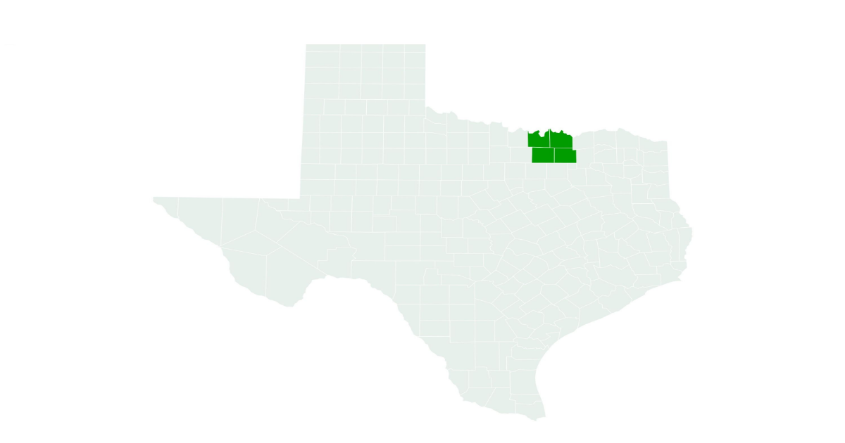
As of Wednesday morning, the warnings covered several counties, including Collin, Cooke, Denton and Grayson.
According to a forecast from AccuWeather issued to Newsweek on Monday, large hail, localized damaging wind gusts up to 70 miles per hour and even isolated tornados would be possible on Wednesday in a risk area extending from north Texas to Nebraska.
The NWS says a severe thunderstorm watch indicates that conditions are favorable for the development of severe thunderstorms in and around the designated area. People in these regions should stay alert for potentially dangerous weather, monitor updates, and be prepared for possible warnings.
Severe thunderstorms are capable of producing tornadoes, though not always.
The SPC said strong gusts would be the primary severe weather risk with the storms. Hail up to two inches in diameter would be possible.
At the time of writing, flood warnings were also in place for some parts of the states, including West Fork Trinity River near Jacksboro and Menard Creek near Rye affecting Polk, Liberty and Hardin Counties.
What People Are Saying
The NWS forecast office at Fort Worth said on X, Tuesday: “We are still monitoring two potential rounds of storms this evening into tonight. First will be isolated storms across central TX this evening. The second, A late night storm complex from the west. Small hail and a severe wind gust or two can’t be ruled out.”
NWS Fort Worth said on X, Wednesday: “A severe thunderstorm is now moving across Wise county, just east of Bridgeport. Large hail up to 1″ and 60 mph winds are the main threats.”
NWS Fort Worth on the NWS website: “A Severe Thunderstorm Watch remains in effect through 7 AM for four counties in North Texas. Large hail and damaging winds remain the main threat.”
Meteorologist Matt Hines said on X: “A Severe Thunderstorm WATCH has been issued until 7am for areas west of I-35 in Central Texas. Any severe weather will like be isolated.”
What Happens Next
Residents should continue monitoring local weather updates and heed precautionary advice as conditions evolve.