From James Spann and the ABC 33/40 Weather Blog:
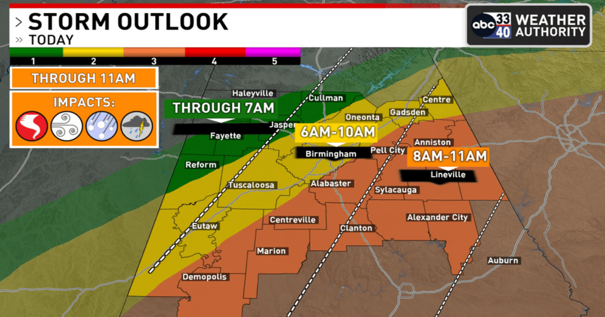
RADAR CHECK: Just before daybreak strong storms are over Northwest Alabama, extending into eastern Mississippi. A flash flood warning has been issued for parts of Colbert, Franklin, and Lawrence counties, where over two inches of rain has fallen early this morning.
A severe thunderstorm watch is in effect for the northern half of Alabama through noon today.
As the storms sweep through Alabama this morning they will be capable of producing strong straight line winds and hail. The chance of a tornado is very low, but not zero. The storms will exit the southeast corner of the state early this afternoon.
The sky will clear tonight as cooler, drier air arrives. Temperatures drop into the 40s early tomorrow morning over much of the state. Then, the day tomorrow will be dry with a partly to mostly sunny sky along with a high in the 70s.
SUMMER PREVIEW: A strong upper ridge will bring a summer preview to Alabama over the latter half of the week, with afternoon highs in the 85 to 90 degree range. This ridge will likely keep showers and storms north and west of Alabama, but a few strong storms could creep into the northwest corner of the state Wednesday evening. These are the daily record highs for Birmingham
April 3 – 87 (1999)
April 4 – 88 (1934)
April 5 – 88 (2010)
If we do reach 90 degrees on one of these days, it won’t be the earlier 90 degree temperature on record; that happened on March 21, 1907.
THE WEEKEND: Saturday will be another very warm, dry day with a high in the mid to upper 80s, but the ridge breaks down allowing showers and thunderstorms to return Sunday.
Much cooler air follows the rain Sunday, and there will be some risk of frost and a late season freeze for parts of Alabama by April 7-8.