Ten tornadoes were reported in western Nebraska on Sunday.
More than 36 million Americans are on alert for severe weather in the Upper Midwest, with thunderstorms, large hail and a tornado outbreak possible starting Monday.
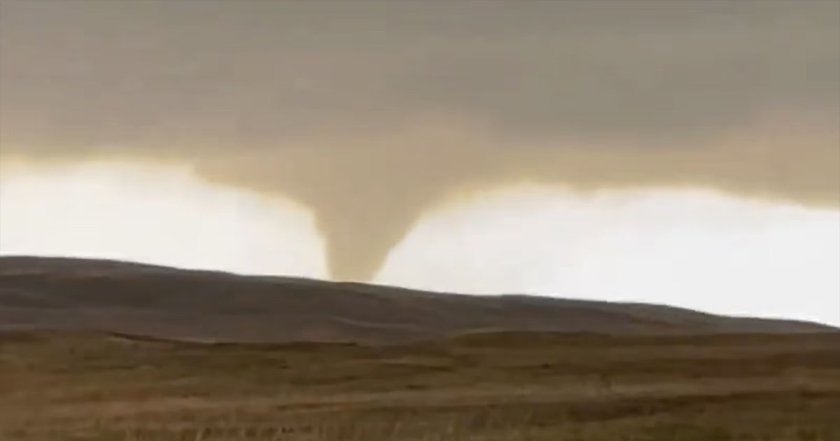
On Sunday, 10 tornadoes and hail larger than a baseball were reported in western Nebraska. Near Hyannis, Nebraska, a train was derailed by a tornado, according to the Nebraska State Patrol.
Additionally, locations in both Texas and South Dakota reported wind gusts reaching 75 mph.

Destructive winds and tornadoes are possible in the Upper Midwest on Monday, April 28, 2025.
The severe weather conditions will continue to ramp up on Monday, with a moderate risk in place for northern Iowa, eastern Minnesota — including Minneapolis — and western Wisconsin. These areas face the greatest likelihood for strong tornadoes, very large hail and destructive thunderstorm wind.
Enhanced risks are also in place from Kansas City, Missouri, to Green Bay, Wisconsin; Duluth, Minnesota; Sioux Falls, South Dakota; and Marquette, Michigan. A second enhanced risk is in place from west Texas to western Oklahoma. Tornadoes, damaging wind and large hail are also a possibility in these areas.
There is also a slight risk for severe weather in place from west Texas to the western Great Lakes, including Oklahoma City and Chicago.
The severe storms are likely to start popping up late in the afternoon on Monday in Minnesota and northern Iowa. As the storms continue to move east into Wisconsin, the longevity of the storms depends on how much the atmosphere has been able to recover from prior showers earlier in the morning.
Additional storms are expected for Kansas City and Oklahoma City around midnight.

The possibility for severe weather continues on Tuesday, with an enhanced risk in place from central Ohio to western New York. Damaging wind, tornadoes and large hail are all possible in these areas. A slight risk for severe storms is also in place from western Texas all the way up to northern Vermont.
A moderate risk for excessive rainfall is also in place over northern Texas, central Oklahoma, southeast Kansas and southwestern Missouri starting Tuesday afternoon and continuing into Tuesday evening.

Up to seven inches of rain, large hail, strong winds and possible tornadoes are likely in these areas, causing a heightened risk to Oklahoma and northern Texas, where heavy rain already occurred throughout the weekend.
One person died on Saturday due to the flash flooding in Oklahoma, according to police. Highly saturated top-soil and local streams running at high levels increases the risk for additional flash flooding in the area after these incoming storms.

Going into Wednesday, a moderate risk for excessive rainfall will be focused on eastern Oklahoma and western Arkansas, potentially bringing additional heavy rain, which will continue the enhanced threat for flash flooding.