![]() By Jeff Ray, McKenna King, Matthew Davisson
By Jeff Ray, McKenna King, Matthew Davisson
Updated on: April 20, 2025 / 1:09 AM CDT / CBS Texas
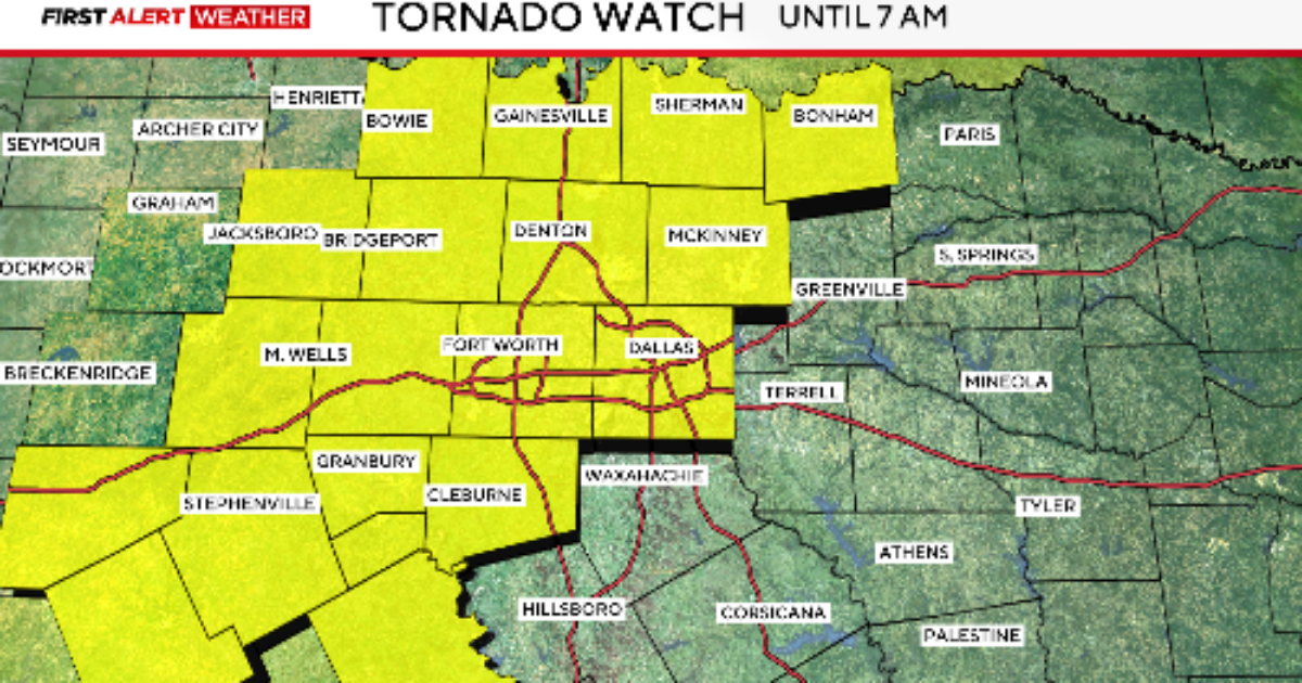
The National Weather Service has issued a tornado watch for parts of North Texas until 7 a.m. Sunday morning.
The watch does include Dallas, Tarrant, Collin and Denton Counties.

Storms will move across the North Texas area overnight, which the main threat will be the threat of hail and flash flooding.
Most of the storms will be out of the area by mid-morning on Sunday.
Numerous tornado warnings were issued Saturday evening, starting shortly after 6 p.m. and continuing through the 11 p.m. hour.

A Flood Watch remains in effect for this area until Sunday morning.

Significant amounts of rain is still expected overnight. Flooding is likely in our watch areas.

On Easter Sunday, North Texas has a high chance of showers and storms during the early morning hours, bringing a flood threat as a cold front moves through.


However, by the time it reaches mid-morning and early afternoon, most of those showers start to push out to the east.
As the afternoon hours approach, expect some sun as the cold front will have moved through the area. Temperatures start in the lower 60s during the morning, then head to the mid-70s during the afternoon.

Timeline for severe weather chances in North Texas
Easter Sunday early morning:
- Heavy rain, with training storms
- Elevated flood risk
Easter Sunday mid-morning:
- Storms move to the east of DFW
CBS News Texas will be tracking the storms all weekend long. Download the CBS News app and search for the “Texas” section.

Jeff joined CBS 11 and TXA 21 in December 2010 as a staff Meteorologist. An avid gardener, you can catch his weekly Gardening 101 series on Fridays on CBS 11. Born in Lubbock, Jeff received his bachelor’s degree in broadcast meteorology from Mississippi State University. He also holds a master’s degree in science education from the University of Missouri at Kansas City. Jeff’s broadcast career spans over 35 years.
© 2025 CBS Broadcasting Inc. All Rights Reserved.