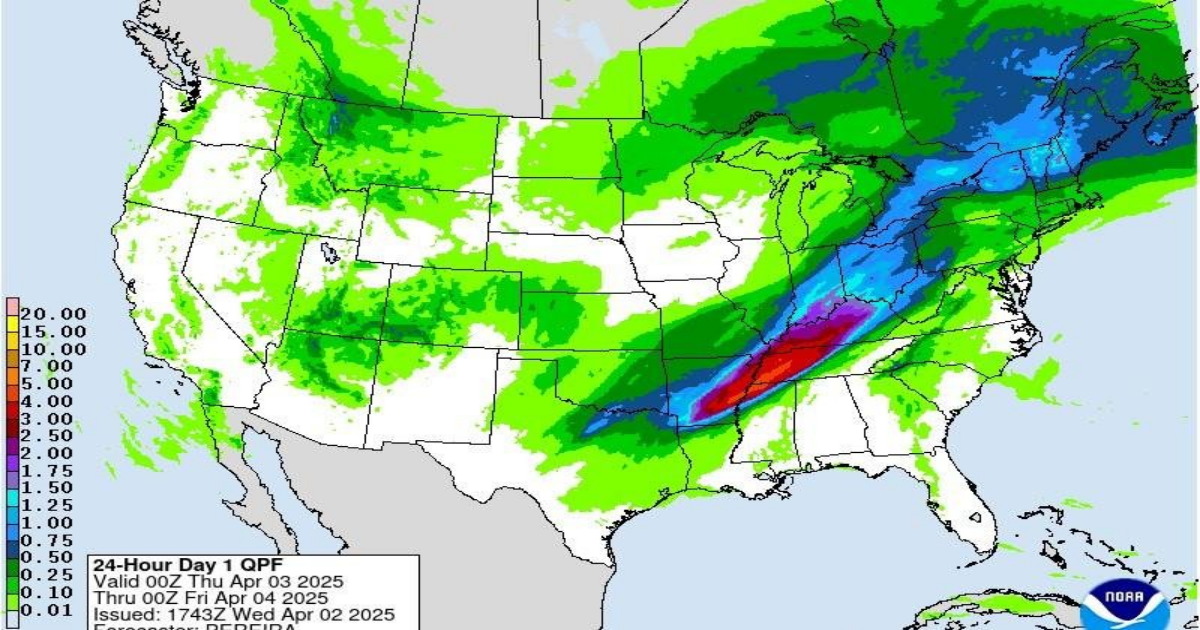
April 2 (UPI) — Severe weather is predicted for the central United States, including potentially deadly tornadoes, large hail and localized flooding that could affect as many as 32 million people through Sunday from Dallas to Cleveland.
The Mississippi Valley is especially vulnerable with severe weather warnings as storms traveling about 60 mph move from the Great Plains through the Mississippi Valley and into the Upper Midwest over the next several days, according to the National Weather Service’s Storm Prediction Center.
“A tornado outbreak is expected this afternoon into early tonight in the lower Mississippi Valley into the Mid-South and lower Ohio Valley,” the SPC said. “Numerous tornadoes, along with multiple EF3+ tornadoes, appear likely.”
An EF3 tornado has wind speeds of between 136 and 165 mph, according to the NWS’s enhanced Fujita scale.
The storm system is expected to carry a lot of moisture and result in excessive rainfall that could cause localized flooding from Little Rock, Ark., to Louisville, Ky.
More than 32 million people are in areas subject to flood watches in major cities, including Cleveland, Detroit, Indianapolis, Louisville and Cincinnati, ABC News reported.
The flood threat is even worse along the Mississippi Valley, which is at a high risk of severe thunderstorm accompanied by high winds.
High-risk weather warnings are reserved for when weather conditions make forecasters confident dangerous storms are likely to occur, CNN reported.
High-risk warnings of dangerous weather typically are issued about 1% of the time, but it’s the second such warning since the start of March.
The potential for torrential rains, high winds, flooding and tornadoes has spurred preventive actions in several states.
Kentucky Gov. Andy Beshear declared a state of emergency through Sunday — especially for the westernmost communities in the commonwealth that are located along the Mississippi and Ohio rivers.
“Tornadoes are expected, and I know that’s tough to hear,” Beshear said Wednesday in an online announcement.
“These can be strong tornadoes, EF2 and greater,” he added. “We’re really concerned about people’s safety, especially overnight, because when storms or tornadoes hit while people are asleep, that’s when we’ve lost the most people.”
Farther south in Tennessee, the NWS is predicting up to 10 inches of rainfall through Sunday in the greater Nashville area and widespread severe thunderstorm in Memphis starting Wednesday night.
A “strong surge of Gulf air” will fuel the weather starting midday Wednesday with high temperatures in the 80s, along with strong winds and gusts of up to 50 mph, WMC-TV reported.
“Parameters for severe weather will be higher than in recent events and lead to the rare high risk for severe weather for part of the Mid-South with all hazards of damaging wind, large hail and tornadoes,” local weather forecasters reported.
Weather forecasters in Memphis anticipate the storm system will enter the area by 4 p.m. CDT and continue into early Thursday morning before moving out of the region.
“While the severe weather threat may want, the heavy rain threat will not — creating flooding concerns for Thursday morning’s commute,” forecasters said.
Little Rock is under a tornado watch until 4 p.m. CDT, and weather forecasters anticipate up to 10 inches of rainfall through the weekend.
Other areas also are under severe weather watches and related warnings through the weekend.
