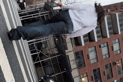
Name that tunnel. Photo: Lorde/Youtube
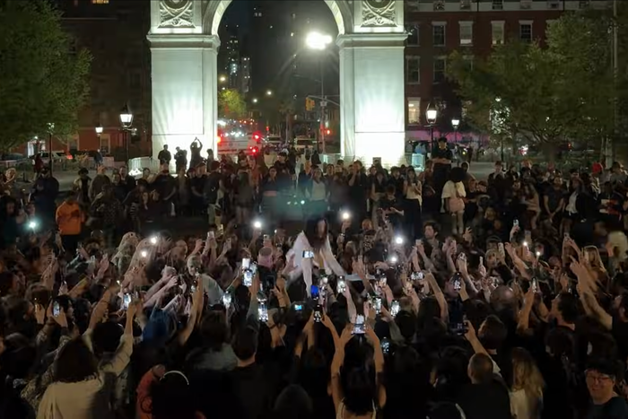
This morning, Lorde dropped “What Was That,” her first major release since 2021 and the one she teased on April 22 with an unannounced appearance in Washington Square Park. It was supposed to be a full-on performance, but she hadn’t gotten a permit so the police put a stop to that. Lorde briefly danced to one of her recordings instead. Video from that evening is prominent in the new song’s video, but we at Curbed were a lot more focused on the two minutes’ worth of film that precedes the park sequence, which consists almost entirely of a walking-and-biking trip along the East Side of Manhattan hugging the waterfront — not a particularly pretty route dominated by blah postwar towers and the cadaverous FDR Drive, which may be why she chose it. Film editing being what it is, her route is a little geographically jumpy but not wildly out of line. And where, exactly, does she go?
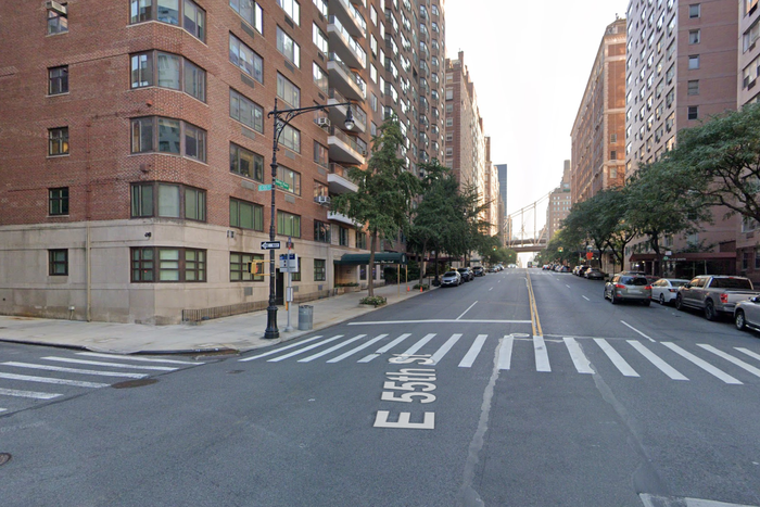
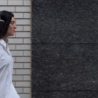
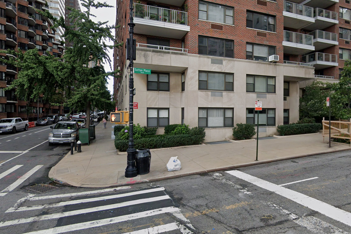
The video’s first shot shows Lorde in a crosswalk; as soon as the camera rises to catch her face, that street is revealed to be Sutton Place South, at the corner of 55th Street.

From left: Photo: Lorde/YoutubePhoto: Google Maps
From top: Photo: Lorde/YoutubePhoto: Google Maps
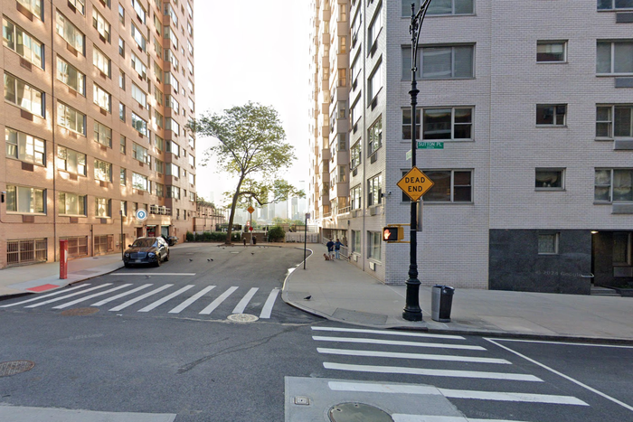
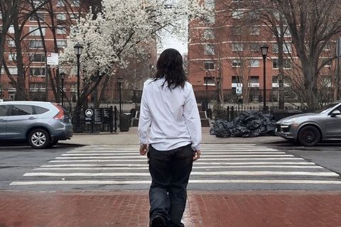
The camera pans to follow her across and down the street, and she passes 45 Sutton Place South, at the corner of 54th.
Clockwise from top left: Photo: Lorde/YoutubePhoto: Lorde/YoutubePhoto: Google Maps
From top: Photo: Lorde/YoutubePhoto: Lorde/YoutubePhoto: Google Maps
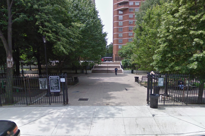
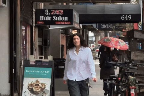
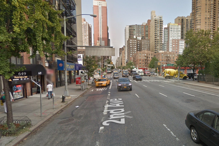
From there, it’s around the corner — and we are instantly transported to Second Avenue and 28th Street near the central plaza in Kips Bay Court that cuts through to First.
From left: Photo: Lorde/YoutubePhoto: Google Maps
From top: Photo: Lorde/YoutubePhoto: Google Maps
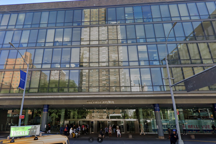
A brief reverse-angle shot catches part of Bellevue Hospital across from that courtyard on First Avenue.

From left: Photo: Lorde/YoutubePhoto: Google Maps
From top: Photo: Lorde/YoutubePhoto: Google Maps
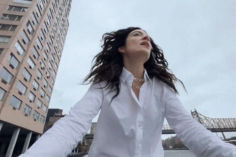
Another abrupt cut and we’re about 30 blocks north. She’s crossing over onto the East Side greenway around 63rd Street, on a bridge recognizable from its high white railing and distinctive lampposts.
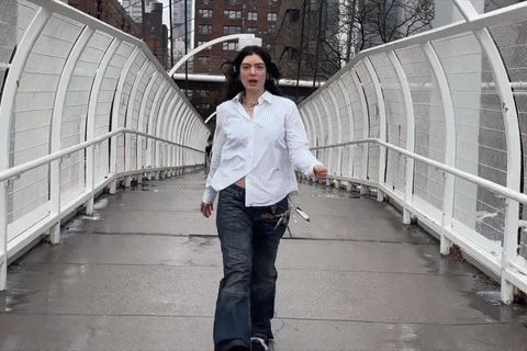
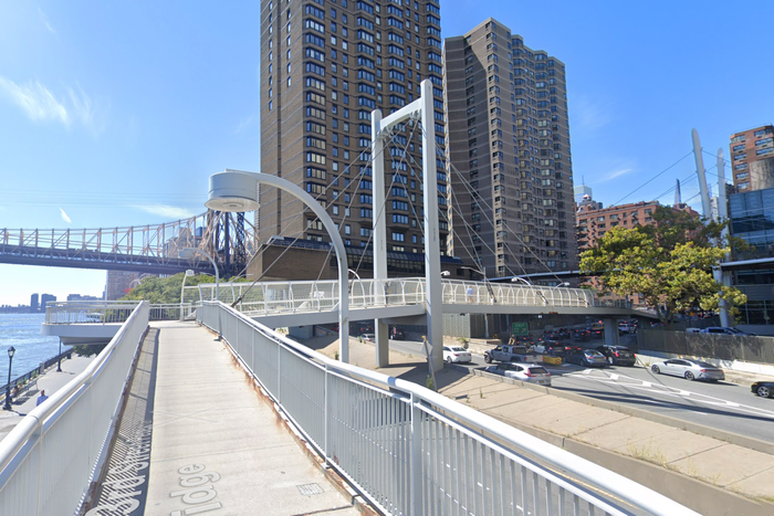
From left: Photo: Lorde/YoutubePhoto: Google Maps
From top: Photo: Lorde/YoutubePhoto: Google Maps
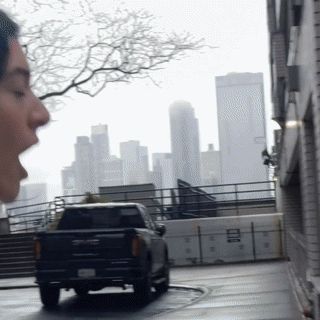
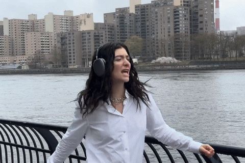
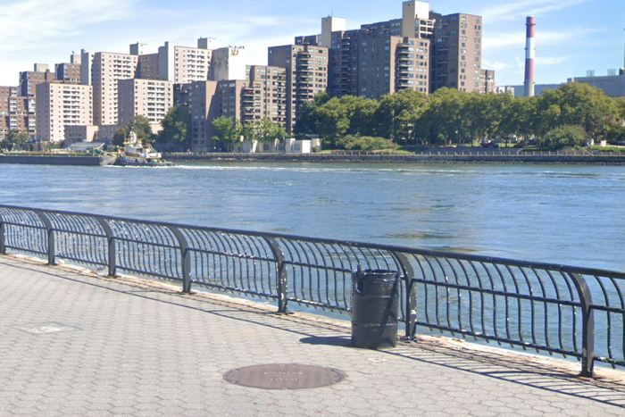
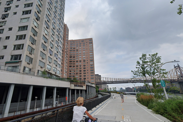
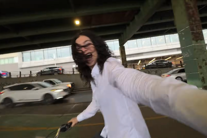
Down on the esplanade, she pauses at the railing and grabs a previously unseen bike (why not?). She removes her headphones too, demonstrating good cyclist behavior.
From left: Photo: Lorde/YoutubePhoto: Google Maps
From top: Photo: Lorde/YoutubePhoto: Google Maps
From there, she starts to ride, heading south. We see her pass the river-facing side of 45 Sutton Place, the same midcentury building that appears in the opening shots.
From left: Photo: Lorde/YoutubePhoto: Google Maps
From top: Photo: Lorde/YoutubePhoto: Google Maps
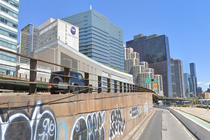
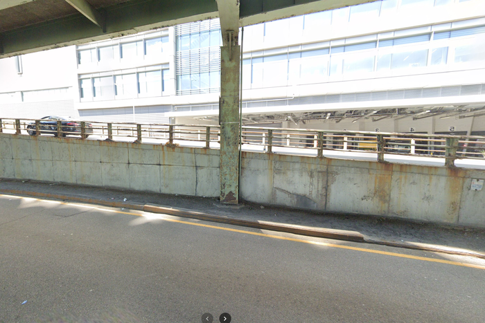
A few more shots accompany her down the bike path and then under the FDR Drive, seen here at about 32nd Street.

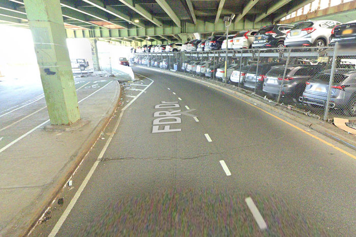
From left: Photo: Lorde/YoutubePhoto: Google Maps
From top: Photo: Lorde/YoutubePhoto: Google Maps
We soon catch a glimpse of NYU Hospital’s Coles Laboratories over her shoulder, a little north of 30th Street.
From left: Photo: Lorde/YoutubePhoto: Google Maps
From top: Photo: Lorde/YoutubePhoto: Google Maps
Whereupon she disembarks and drops the bike, which is … back on Sutton Place South.
From left: Photo: Lorde/YoutubePhoto: Google Maps
From top: Photo: Lorde/YoutubePhoto: Google Maps
She crosses the street and, in the jump cut, is now headed south on Second Avenue just above East 36th Street.

From left: Photo: Lorde/YoutubePhoto: Google Maps
From top: Photo: Lorde/YoutubePhoto: Google Maps
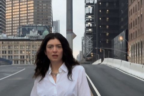
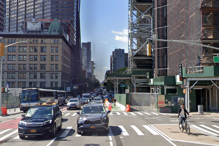
She walks a block south from there, and we see the commercial strip of Second between 34th and 35th.
From left: Photo: Lorde/YoutubePhoto: Google Maps
From top: Photo: Lorde/YoutubePhoto: Google Maps
Now she has turned around and headed up First Avenue around 38th Street. That’s 650 First Avenue on the left, mid-renovation.
From left: Photo: Lorde/YoutubePhoto: Google Maps
From top: Photo: Lorde/YoutubePhoto: Google Maps
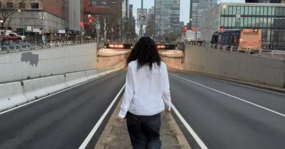
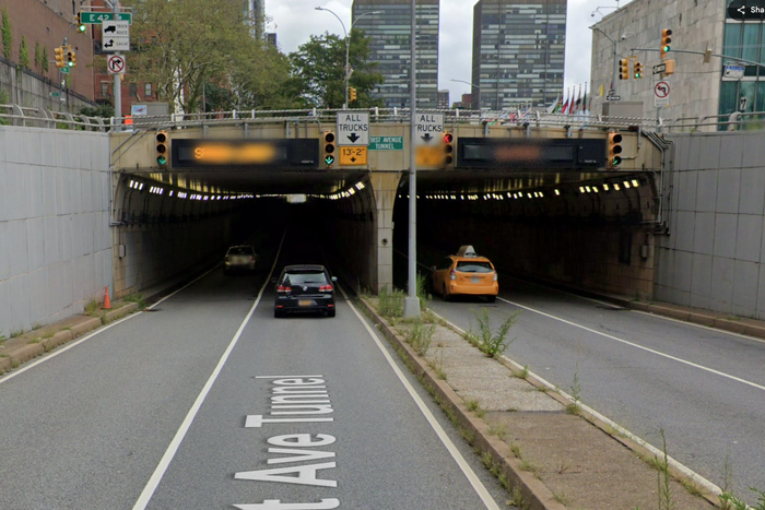
She keeps heading up First until she gets to the tunnel that dips under the United Nations complex, where she heads underground. (Looks cool, but don’t do this unless you are a pop star and have a video crew available to close the street to traffic. You’ll get run over.)

From left: Photo: Lorde/YoutubePhoto: Google Maps
From top: Photo: Lorde/YoutubePhoto: Google Maps
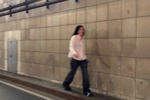
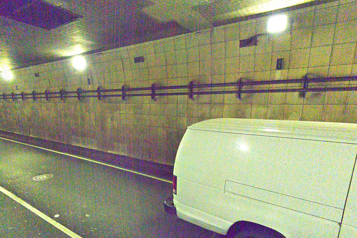
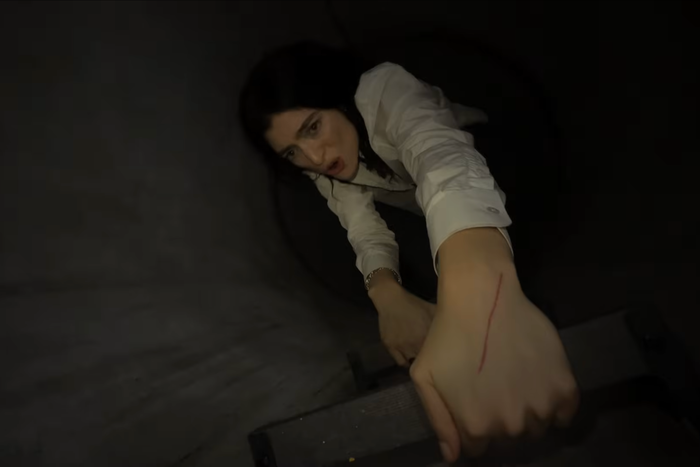
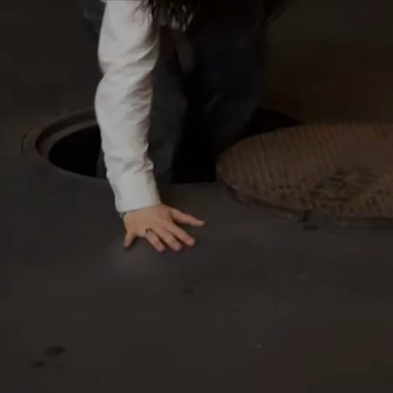
She makes her way into the tunnel along the narrow access walkway and then comes to a door that leads to an unidentified ladder-companionway-tunnel under the street …
From left: Photo: Lorde/YoutubePhoto: Google Maps
From top: Photo: Lorde/YoutubePhoto: Google Maps

From left: Photo: Lorde/YoutubePhoto: Lorde/Youtube
From top: Photo: Lorde/YoutubePhoto: Lorde/Youtube
… from which she emerges, via manhole, in recognizable-to-anyone Washington Square Park, the site of her concert the other night. It’s a party! Lorde lives in the Village, so she could have walked over had she not made a series of detours to Sutton Place South.
Clockwise from top left: Photo: Lorde/YoutubePhoto: Lorde/YoutubePhoto: Lorde/Youtube
From top: Photo: Lorde/YoutubePhoto: Lorde/YoutubePhoto: Lorde/Youtube
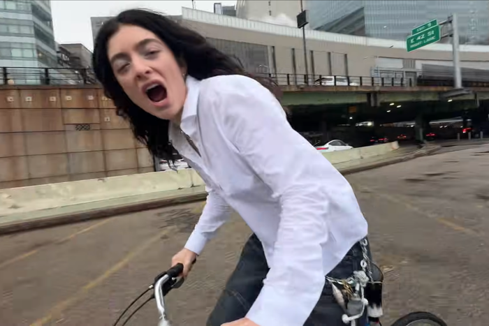
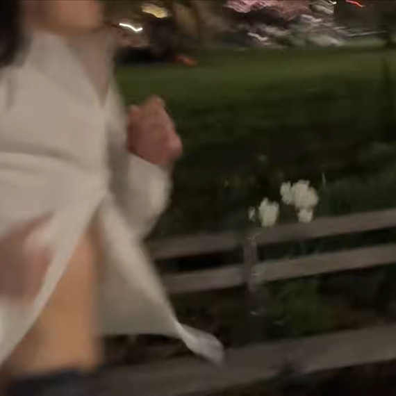
Most of the remainder of the video is exuberant concert footage. But there are a few cuts back to Lorde on her bicycle, mostly down under the FDR Drive in the East 30s. We get a brief look at NYU’s Smilow Research Center before it wraps up.
From left: Photo: Lorde/YoutubePhoto: Google Maps
From top: Photo: Lorde/YoutubePhoto: Google Maps
After listening to the song 50 or so times in one morning while staring at the buildings in the background, I can also report that “What Was That” is a banger. Lorde: good musician, good urbanist.
Here’s the whole video, by the way, in case you didn’t start with it.